
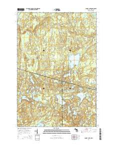
~ Chaney Lake MI topo map, 1:24000 scale, 7.5 X 7.5 Minute, Historical, 2014
Chaney Lake, Michigan, USGS topographic map dated 2014.
Includes geographic coordinates (latitude and longitude). This topographic map is suitable for hiking, camping, and exploring, or framing it as a wall map.
Printed on-demand using high resolution imagery, on heavy weight and acid free paper, or alternatively on a variety of synthetic materials.
Topos available on paper, Waterproof, Poly, or Tyvek. Usually shipping rolled, unless combined with other folded maps in one order.
- Product Number: USGS-7264328
- Free digital map download (high-resolution, GeoPDF): Chaney Lake, Michigan (file size: 42 MB)
- Map Size: please refer to the dimensions of the GeoPDF map above
- Weight (paper map): ca. 55 grams
- Map Type: POD USGS Topographic Map
- Map Series: US Topo
- Map Verison: Historical
- Cell ID: 8136
- Datum: North American Datum of 1983
- Map Projection: Transverse Mercator
- Map Cell Name: Chaney Lake
- Grid size: 7.5 X 7.5 Minute
- Date on map: 2014
- Map Scale: 1:24000
- Geographical region: Michigan, United States
Neighboring Maps:
All neighboring USGS topo maps are available for sale online at a variety of scales.
Spatial coverage:
Topo map Chaney Lake, Michigan, covers the geographical area associated the following places:
- Hawk Lake - Hook Lake - Lynx Lake - Mary Lake - Marion Lake - Little Oak Lake - Spinnet Lake - Chaney Lake - Jeannie Lake - Woods Lake - Negro Lakes - Mosinee Creek - Otter Lake - No Mans Creek - Gretchen Lake - Swamp Lake - Troste Lookout Tower - Lake Franchian - Lake Helen - Camp Twelve Lake - Owl Lake - Fox Lake - George Lake - Beatrice Lake - Lake Rose - Hewitt Lake - Hill Lake - Bena Lake - Mary Lake State Natural Area - Pardee Lake - Oak Lake - No Mans Lake - Dumbell Lake - McFadyen Dam - Christopher Creek - Joann Lake - Trostel Lake - Findler Lake - Marell Lake - Virgin Lake - Pardee Creek - Etna Lake - Cranberry Lake - Constance Lake - Lake Yolanda
- Map Area ID: AREA46.37546.25-90-89.875
- Northwest corner Lat/Long code: USGSNW46.375-90
- Northeast corner Lat/Long code: USGSNE46.375-89.875
- Southwest corner Lat/Long code: USGSSW46.25-90
- Southeast corner Lat/Long code: USGSSE46.25-89.875
- Northern map edge Latitude: 46.375
- Southern map edge Latitude: 46.25
- Western map edge Longitude: -90
- Eastern map edge Longitude: -89.875


