
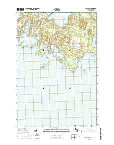
~ Whitney Bay MI topo map, 1:24000 scale, 7.5 X 7.5 Minute, Historical, 2014
Whitney Bay, Michigan, USGS topographic map dated 2014.
Includes geographic coordinates (latitude and longitude). This topographic map is suitable for hiking, camping, and exploring, or framing it as a wall map.
Printed on-demand using high resolution imagery, on heavy weight and acid free paper, or alternatively on a variety of synthetic materials.
Topos available on paper, Waterproof, Poly, or Tyvek. Usually shipping rolled, unless combined with other folded maps in one order.
- Product Number: USGS-7263167
- Free digital map download (high-resolution, GeoPDF): Whitney Bay, Michigan (file size: 26 MB)
- Map Size: please refer to the dimensions of the GeoPDF map above
- Weight (paper map): ca. 55 grams
- Map Type: POD USGS Topographic Map
- Map Series: US Topo
- Map Verison: Historical
- Cell ID: 48914
- Datum: North American Datum of 1983
- Map Projection: Transverse Mercator
- Map Cell Name: Whitney Bay
- Grid size: 7.5 X 7.5 Minute
- Date on map: 2014
- Map Scale: 1:24000
- Geographical region: Michigan, United States
Neighboring Maps:
All neighboring USGS topo maps are available for sale online at a variety of scales.
Spatial coverage:
Topo map Whitney Bay, Michigan, covers the geographical area associated the following places:
- Espanore Lake - Cream City Point - Huron Bay - Helen Lake - Clark Island - Cove Island - Garden Island - Bootjack Island - Parish Lake - Isaacson Lake - Long Island - Bird Island - Drummond Township Park - Baileys Lake - Surgeon Island - Jackson Lake - Pigeon Cove - Cove Point - Squeaky Lake - Bear Lake - Duck Island - Pike Bay - Fisher Island - Espanore Island - Whitney Bay - Kempaien Lake - Boot Lake - Island Harbor - Pigeon Point - Arnold Island - Jones Lake - Gravel Island - Drummond Township Park - Maushie Creek - Drummond Dolomite Quarry - Silver Island - Point Anderson - Seaman Lake - Gravel Lake - Bellevue Island - Old Fort Drummond - Fort Drummond Marina - Fairview Cove - Pigeon Cove Creek - Fairbank Point
- Map Area ID: AREA4645.875-83.875-83.75
- Northwest corner Lat/Long code: USGSNW46-83.875
- Northeast corner Lat/Long code: USGSNE46-83.75
- Southwest corner Lat/Long code: USGSSW45.875-83.875
- Southeast corner Lat/Long code: USGSSE45.875-83.75
- Northern map edge Latitude: 46
- Southern map edge Latitude: 45.875
- Western map edge Longitude: -83.875
- Eastern map edge Longitude: -83.75


