
~ Todd Harbor MI topo map, 1:24000 scale, 7.5 X 7.5 Minute, Historical, 2014
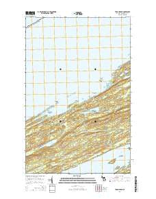
Todd Harbor, Michigan, USGS topographic map dated 2014.
Includes geographic coordinates (latitude and longitude). This topographic map is suitable for hiking, camping, and exploring, or framing it as a wall map.
Printed on-demand using high resolution imagery, on heavy weight and acid free paper, or alternatively on a variety of synthetic materials.
Topos available on paper, Waterproof, Poly, or Tyvek. Usually shipping rolled, unless combined with other folded maps in one order.
- Product Number: USGS-7263007
- Free digital map download (high-resolution, GeoPDF): Todd Harbor, Michigan (file size: 28 MB)
- Map Size: please refer to the dimensions of the GeoPDF map above
- Weight (paper map): ca. 55 grams
- Map Type: POD USGS Topographic Map
- Map Series: US Topo
- Map Verison: Historical
- Cell ID: 45284
- Datum: North American Datum of 1983
- Map Projection: Transverse Mercator
- Map Cell Name: Todd Harbor
- Grid size: 7.5 X 7.5 Minute
- Date on map: 2014
- Map Scale: 1:24000
- Geographical region: Michigan, United States
Neighboring Maps:
All neighboring USGS topo maps are available for sale online at a variety of scales.
Spatial coverage:
Topo map Todd Harbor, Michigan, covers the geographical area associated the following places:
- Ryan Island - Hatchet Lake Campground - Todd Harbor Campground - Twelve O'Clock Point - Haytown Mine - Greenstone Ridge - Mount Siskiwit - Kamloops Point - Arch Island - Taylor Island - Hatchett Lake Trail - Wilson Island - Siskiwit Lake - Wilson Point - Green Isle - Minong Ridge Fire Manway - Otter Lake - Beaver Lake - Teakettle Island - Florence Bay - Hatchet Lake - Isle Royale National Park - Todd Harbor - Greenstone Ridge Trail - Lake Harvey - Kamloops Island - Pickett Bay
- Map Area ID: AREA48.12548-88.875-88.75
- Northwest corner Lat/Long code: USGSNW48.125-88.875
- Northeast corner Lat/Long code: USGSNE48.125-88.75
- Southwest corner Lat/Long code: USGSSW48-88.875
- Southeast corner Lat/Long code: USGSSE48-88.75
- Northern map edge Latitude: 48.125
- Southern map edge Latitude: 48
- Western map edge Longitude: -88.875
- Eastern map edge Longitude: -88.75


