
~ Point Houghton MI topo map, 1:24000 scale, 7.5 X 7.5 Minute, Historical, 2014
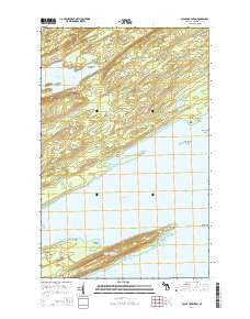
Point Houghton, Michigan, USGS topographic map dated 2014.
Includes geographic coordinates (latitude and longitude). This topographic map is suitable for hiking, camping, and exploring, or framing it as a wall map.
Printed on-demand using high resolution imagery, on heavy weight and acid free paper, or alternatively on a variety of synthetic materials.
Topos available on paper, Waterproof, Poly, or Tyvek. Usually shipping rolled, unless combined with other folded maps in one order.
- Product Number: USGS-7262460
- Free digital map download (high-resolution, GeoPDF): Point Houghton, Michigan (file size: 32 MB)
- Map Size: please refer to the dimensions of the GeoPDF map above
- Weight (paper map): ca. 55 grams
- Map Type: POD USGS Topographic Map
- Map Series: US Topo
- Map Verison: Historical
- Cell ID: 61294
- Datum: North American Datum of 1983
- Map Projection: Transverse Mercator
- Map Cell Name: Point Houghton
- Grid size: 7.5 X 7.5 Minute
- Date on map: 2014
- Map Scale: 1:24000
- Geographical region: Michigan, United States
Neighboring Maps:
All neighboring USGS topo maps are available for sale online at a variety of scales.
Spatial coverage:
Topo map Point Houghton, Michigan, covers the geographical area associated the following places:
- Point Hay - Lake Desor - Senter Point - Siskiwit Bay - Mud Lake - Siskiwit Bay Campground - Isle Royale Wilderness - Fishermans Home Cove - Little Siskiwit River - Little Boat Harbor - Hay Bay - Point Houghton - Francis Point - Butterfield Point - Houghton Ridge - Checker Point - Lake Desor Campground (historical) - South Lake Desor Campground - Butterfield Shoal - Hay Bay Campground - Brandsford Reef - Isle Royale - Finn Point - Little Siskiwit Island - North Lake Desor Campground - Ishpeming Point - Spruce Point - Houghton Point Passage - Township of Eagle Harbor
- Map Area ID: AREA4847.875-89-88.875
- Northwest corner Lat/Long code: USGSNW48-89
- Northeast corner Lat/Long code: USGSNE48-88.875
- Southwest corner Lat/Long code: USGSSW47.875-89
- Southeast corner Lat/Long code: USGSSE47.875-88.875
- Northern map edge Latitude: 48
- Southern map edge Latitude: 47.875
- Western map edge Longitude: -89
- Eastern map edge Longitude: -88.875


