
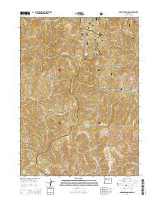
~ Josephine Mountain OR topo map, 1:24000 scale, 7.5 X 7.5 Minute, Current, 2014
Josephine Mountain, Oregon, USGS topographic map dated 2014.
Includes geographic coordinates (latitude and longitude). This topographic map is suitable for hiking, camping, and exploring, or framing it as a wall map.
Printed on-demand using high resolution imagery, on heavy weight and acid free paper, or alternatively on a variety of synthetic materials.
Topos available on paper, Waterproof, Poly, or Tyvek. Usually shipping rolled, unless combined with other folded maps in one order.
- Product Number: USGS-7260848
- Free digital map download (high-resolution, GeoPDF): Josephine Mountain, Oregon (file size: 41 MB)
- Map Size: please refer to the dimensions of the GeoPDF map above
- Weight (paper map): ca. 55 grams
- Map Type: POD USGS Topographic Map
- Map Series: US Topo
- Map Verison: Current
- Cell ID: 22822
- Datum: North American Datum of 1983
- Map Projection: Transverse Mercator
- Map Cell Name: Josephine Mountain
- Grid size: 7.5 X 7.5 Minute
- Date on map: 2014
- Map Scale: 1:24000
- Geographical region: Oregon, United States
Neighboring Maps:
All neighboring USGS topo maps are available for sale online at a variety of scales.
Spatial coverage:
Topo map Josephine Mountain, Oregon, covers the geographical area associated the following places:
- Morrison Gulch - Canyon Peak - Carpenter Gulch - Rocky Bar Gulch - Eagle Creek - Limber Camp Spring - Copper Creek - Whetstone Butte - Ditch Creek - Bailey Cabin - Emily Cabin - Babyfoot Mine - Alberg Mine - Hawks Rest - Hawk Creek - Cold Springs Camp - Cold Spring - Onion Camp - Hansen Gulch - Josephine Mountain - South Fork Canyon Creek - Babyfoot Lake Area - Rough and Ready Lakes - Fiddler Mountain - Lightning Gulch - Hungry Hill - Doe Gap - Babyfoot Lake
- Map Area ID: AREA42.2542.125-123.875-123.75
- Northwest corner Lat/Long code: USGSNW42.25-123.875
- Northeast corner Lat/Long code: USGSNE42.25-123.75
- Southwest corner Lat/Long code: USGSSW42.125-123.875
- Southeast corner Lat/Long code: USGSSE42.125-123.75
- Northern map edge Latitude: 42.25
- Southern map edge Latitude: 42.125
- Western map edge Longitude: -123.875
- Eastern map edge Longitude: -123.75


