
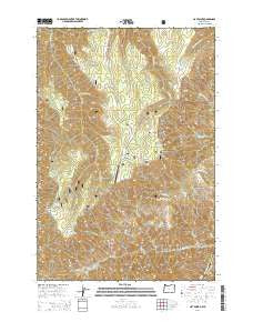
~ Hat Point OR topo map, 1:24000 scale, 7.5 X 7.5 Minute, Current, 2014
Hat Point, Oregon, USGS topographic map dated 2014.
Includes geographic coordinates (latitude and longitude). This topographic map is suitable for hiking, camping, and exploring, or framing it as a wall map.
Printed on-demand using high resolution imagery, on heavy weight and acid free paper, or alternatively on a variety of synthetic materials.
Topos available on paper, Waterproof, Poly, or Tyvek. Usually shipping rolled, unless combined with other folded maps in one order.
- Product Number: USGS-7260062
- Free digital map download (high-resolution, GeoPDF): Hat Point, Oregon (file size: 36 MB)
- Map Size: please refer to the dimensions of the GeoPDF map above
- Weight (paper map): ca. 55 grams
- Map Type: POD USGS Topographic Map
- Map Series: US Topo
- Map Verison: Current
- Cell ID: 19624
- Datum: North American Datum of 1983
- Map Projection: Transverse Mercator
- Map Cell Name: Hat Point
- Grid size: 7.5 X 7.5 Minute
- Date on map: 2014
- Map Scale: 1:24000
- Geographical region: Oregon, United States
Neighboring Maps:
All neighboring USGS topo maps are available for sale online at a variety of scales.
Spatial coverage:
Topo map Hat Point, Oregon, covers the geographical area associated the following places:
- Horse Creek Viewpoint - Memaloose Airport - Rough Creek - Mud Spring - Freezeout Saddle - Hat Point Lookout Tower - Saddle Creek Recreation Site - High Trail - Granny Spring - Granny View Point - Sluice Creek Saddle - Upper Snake River Trail - Big Creek - East Fork Horse Creek - Hoodoo Spring - Log Creek - Audison Creek - Western Rim National Recreation Trail - Monument Ridge - Hat Point Recreation Site - Indian Grave Creek - Memaloose Guard Station - Warnock Corral Trailhead - Helitack Base - Jim Spring - Hat Point Lookout Tower - Sacajawea Spring - Twobuck Creek - Summit Ridge - Granny View Forest Service Station (historical) - Grizzly Ridge - Warnock Corral - Granny View Recreation Site - Horse Creek Cabin - Sacajawea Recreation Site - Hat Point
- Map Area ID: AREA45.545.375-116.75-116.625
- Northwest corner Lat/Long code: USGSNW45.5-116.75
- Northeast corner Lat/Long code: USGSNE45.5-116.625
- Southwest corner Lat/Long code: USGSSW45.375-116.75
- Southeast corner Lat/Long code: USGSSE45.375-116.625
- Northern map edge Latitude: 45.5
- Southern map edge Latitude: 45.375
- Western map edge Longitude: -116.75
- Eastern map edge Longitude: -116.625


