
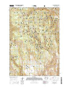
~ Flag Prairie OR topo map, 1:24000 scale, 7.5 X 7.5 Minute, Current, 2014
Flag Prairie, Oregon, USGS topographic map dated 2014.
Includes geographic coordinates (latitude and longitude). This topographic map is suitable for hiking, camping, and exploring, or framing it as a wall map.
Printed on-demand using high resolution imagery, on heavy weight and acid free paper, or alternatively on a variety of synthetic materials.
Topos available on paper, Waterproof, Poly, or Tyvek. Usually shipping rolled, unless combined with other folded maps in one order.
- Product Number: USGS-7259634
- Free digital map download (high-resolution, GeoPDF): Flag Prairie, Oregon (file size: 37 MB)
- Map Size: please refer to the dimensions of the GeoPDF map above
- Weight (paper map): ca. 55 grams
- Map Type: POD USGS Topographic Map
- Map Series: US Topo
- Map Verison: Current
- Cell ID: 15438
- Datum: North American Datum of 1983
- Map Projection: Transverse Mercator
- Map Cell Name: Flag Prairie
- Grid size: 7.5 X 7.5 Minute
- Date on map: 2014
- Map Scale: 1:24000
- Geographical region: Oregon, United States
Neighboring Maps:
All neighboring USGS topo maps are available for sale online at a variety of scales.
Spatial coverage:
Topo map Flag Prairie, Oregon, covers the geographical area associated the following places:
- Bingham Point - Lost Dog Gulch - Flag Prairie Cow Camp - Hunter Creek - Canteeno Spring - Bear Creek Meadow - Tongue Gulch - Red Hill Spring - Raw Dog Creek - Station Creek - Kate Spring - Sagehen Gulch - WPA Reservoir - Root Spring - Willow Spring - Rattlesnake Ridge - Turner Spring - Crane Creek Campground - Schlupe Spring - Station Spring - Aspen Creek - JB Reservoir - Prairie Hill - Tub Spring - Cold Spring - Canteen Creek - Lost Dog Reservoir - Kate Creek - Burned Tree Reservoir - Crane Creek - Flag Prairie - Lost Dog Flat - Monkey Run - Sage Hen Spring - Lightning Spring - Horseshoe Spring - Aspen Spring - Gib Spring - Lava Spring - ERA Spring - Little Malheur River Recreation Site - Hunter Spring - Seven D Bar Spring - Buck Spring - Tamarack Spring - Pine Tree Spring - Sheep Gulch - Dutch Oven Reservoir - Mud Flat Reservoir - Camp Creek - McKenzie Spring - Alarm Clock Spring
- Map Area ID: AREA44.2544.125-118.375-118.25
- Northwest corner Lat/Long code: USGSNW44.25-118.375
- Northeast corner Lat/Long code: USGSNE44.25-118.25
- Southwest corner Lat/Long code: USGSSW44.125-118.375
- Southeast corner Lat/Long code: USGSSE44.125-118.25
- Northern map edge Latitude: 44.25
- Southern map edge Latitude: 44.125
- Western map edge Longitude: -118.375
- Eastern map edge Longitude: -118.25


