
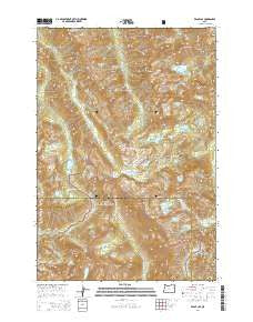
~ Eagle Cap OR topo map, 1:24000 scale, 7.5 X 7.5 Minute, Current, 2014
Eagle Cap, Oregon, USGS topographic map dated 2014.
Includes geographic coordinates (latitude and longitude). This topographic map is suitable for hiking, camping, and exploring, or framing it as a wall map.
Printed on-demand using high resolution imagery, on heavy weight and acid free paper, or alternatively on a variety of synthetic materials.
Topos available on paper, Waterproof, Poly, or Tyvek. Usually shipping rolled, unless combined with other folded maps in one order.
- Product Number: USGS-7259352
- Free digital map download (high-resolution, GeoPDF): Eagle Cap, Oregon (file size: 39 MB)
- Map Size: please refer to the dimensions of the GeoPDF map above
- Weight (paper map): ca. 55 grams
- Map Type: POD USGS Topographic Map
- Map Series: US Topo
- Map Verison: Current
- Cell ID: 13234
- Datum: North American Datum of 1983
- Map Projection: Transverse Mercator
- Map Cell Name: Eagle Cap
- Grid size: 7.5 X 7.5 Minute
- Date on map: 2014
- Map Scale: 1:24000
- Geographical region: Oregon, United States
Neighboring Maps:
All neighboring USGS topo maps are available for sale online at a variety of scales.
Spatial coverage:
Topo map Eagle Cap, Oregon, covers the geographical area associated the following places:
- Sunshine Lake - Eagle Cap - Horton Pass - Unit Lake - Lake Basin - Craig Mountain - Cusick Mountain - East Lostine River - Knight Creek - Frazier Lake - Hidden Lake - Lee Lake - Wallowa Mountains - Moon Lake - Benson Glacier - Matterhorn - Craig Lake - Horseshoe Lake - Razz Lake - Prospect Lake - Ice Lake - Pocket Lake - Glacier Pass - Glacier Lake - Upper Lake - Granite Lake - Little Pop Lake - Frazier Pass - Sacajawea Peak - Dennis Creek - Blue Lake - Lilly Lake - Crescent Lake - Minam Lake Dam - River Head Camp (historical) - Two Pan Trailhead - Douglas Lake - Moccasin Lake - Pop Creek - Copper Creek - Eagle Lake - Jackson Peak - Little Frazier Lake - Eagle Lake Dam - Hawkins Pass - Needle Point - Mirror Lake - Brown Mountain - Pop Lake - Minam Lake
- Map Area ID: AREA45.2545.125-117.375-117.25
- Northwest corner Lat/Long code: USGSNW45.25-117.375
- Northeast corner Lat/Long code: USGSNE45.25-117.25
- Southwest corner Lat/Long code: USGSSW45.125-117.375
- Southeast corner Lat/Long code: USGSSE45.125-117.25
- Northern map edge Latitude: 45.25
- Southern map edge Latitude: 45.125
- Western map edge Longitude: -117.375
- Eastern map edge Longitude: -117.25


