
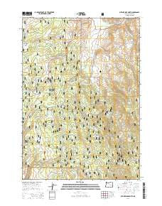
~ Devine Ridge North OR topo map, 1:24000 scale, 7.5 X 7.5 Minute, Current, 2014
Devine Ridge North, Oregon, USGS topographic map dated 2014.
Includes geographic coordinates (latitude and longitude). This topographic map is suitable for hiking, camping, and exploring, or framing it as a wall map.
Printed on-demand using high resolution imagery, on heavy weight and acid free paper, or alternatively on a variety of synthetic materials.
Topos available on paper, Waterproof, Poly, or Tyvek. Usually shipping rolled, unless combined with other folded maps in one order.
- Product Number: USGS-7259230
- Free digital map download (high-resolution, GeoPDF): Devine Ridge North, Oregon (file size: 36 MB)
- Map Size: please refer to the dimensions of the GeoPDF map above
- Weight (paper map): ca. 55 grams
- Map Type: POD USGS Topographic Map
- Map Series: US Topo
- Map Verison: Current
- Cell ID: 12129
- Datum: North American Datum of 1983
- Map Projection: Transverse Mercator
- Map Cell Name: Devine Ridge North
- Grid size: 7.5 X 7.5 Minute
- Date on map: 2014
- Map Scale: 1:24000
- Geographical region: Oregon, United States
Neighboring Maps:
All neighboring USGS topo maps are available for sale online at a variety of scales.
Spatial coverage:
Topo map Devine Ridge North, Oregon, covers the geographical area associated the following places:
- Shott Spring - Tommys Spring - Pardee Spring - Rock Spring - South Fork Trout Creek - North Fork Trout Creek - Strawberry Spring - Summit (historical) - Mud Spring - RIL Spring - Idol City Mines - Lonesomehurst Post Office (historical) - Marshall Creek - Flying W Spring - King Spring - Three-Seven Spring - Cold Spring - East Creek - Roach Creek Spring - Abraham Spring - Dickenson Ranch - Idlewild Recreation Site - Van Zandt Meadows - Roach Creek - Devine Ridge - Strawberry Creek - Ponderosa Spring - Gobblers Knob - Larsen Spring - Baker Corral - Marshall Spring - Sand Spring - Cross Ranch - Hardesty Ranch - Hi Desert Ski Area (historical) - Boy Scout Cabin - R K Spring - Purdy Ranch - Kid Flat Spring - Crow Flat - Idol Post Office (historical) - Nelson Ranch - Powerline Spring - Temple Ranch - Williams Field - Parker Spring - Crow Flat Guard Station
- Map Area ID: AREA43.87543.75-119-118.875
- Northwest corner Lat/Long code: USGSNW43.875-119
- Northeast corner Lat/Long code: USGSNE43.875-118.875
- Southwest corner Lat/Long code: USGSSW43.75-119
- Southeast corner Lat/Long code: USGSSE43.75-118.875
- Northern map edge Latitude: 43.875
- Southern map edge Latitude: 43.75
- Western map edge Longitude: -119
- Eastern map edge Longitude: -118.875


