
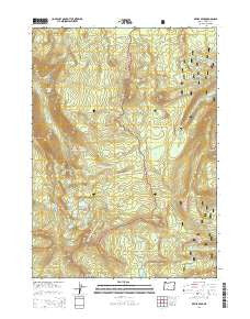
~ Devils Peak OR topo map, 1:24000 scale, 7.5 X 7.5 Minute, Current, 2014
Devils Peak, Oregon, USGS topographic map dated 2014.
Includes geographic coordinates (latitude and longitude). This topographic map is suitable for hiking, camping, and exploring, or framing it as a wall map.
Printed on-demand using high resolution imagery, on heavy weight and acid free paper, or alternatively on a variety of synthetic materials.
Topos available on paper, Waterproof, Poly, or Tyvek. Usually shipping rolled, unless combined with other folded maps in one order.
- Product Number: USGS-7259219
- Free digital map download (high-resolution, GeoPDF): Devils Peak, Oregon (file size: 41 MB)
- Map Size: please refer to the dimensions of the GeoPDF map above
- Weight (paper map): ca. 55 grams
- Map Type: POD USGS Topographic Map
- Map Series: US Topo
- Map Verison: Current
- Cell ID: 12111
- Datum: North American Datum of 1983
- Map Projection: Transverse Mercator
- Map Cell Name: Devils Peak
- Grid size: 7.5 X 7.5 Minute
- Date on map: 2014
- Map Scale: 1:24000
- Geographical region: Oregon, United States
Neighboring Maps:
All neighboring USGS topo maps are available for sale online at a variety of scales.
Spatial coverage:
Topo map Devils Peak, Oregon, covers the geographical area associated the following places:
- Big Bunchgrass - South Lake - Grass Lake Campground Number 2 (historical) - Sevenmile Marsh Trailhead - Finch Lake - Lake Ivern - Cliff Lake Campground (historical) - Sevenmile Marsh Campground - Ethel Mountain - North Lake - Honeymoon Creek - Cliff Lake - Sevenmile Marsh - Devils Peak - Klamath Point - Grass Lake Campground (historical) - Oregon Desert - Lucifer - Grass Lake - Violet Hill - Sevenmile Trail - Boston Bluff - Venus - Alta Campground (historical) - Shale Butte - Lee Peak - Lake Alta - Maude Mountain - Snow Lakes - Dry Creek Trail - Alta Lake Trail - Halifax Trail - Gopher Ridge - Middle Lake - Crippled Horse Spring - Ruth Mountain - South Lake Campground (historical) - Boulder Pond - Moude Mountain Trail - McKie Camp - Seven Lakes Basin - Jupiter - Ranger Spring - Solace Camp - Bunker Hill - Bareface Butte - Puck Lakes - Gardner Peak - Lone Wolf
- Map Area ID: AREA42.7542.625-122.25-122.125
- Northwest corner Lat/Long code: USGSNW42.75-122.25
- Northeast corner Lat/Long code: USGSNE42.75-122.125
- Southwest corner Lat/Long code: USGSSW42.625-122.25
- Southeast corner Lat/Long code: USGSSE42.625-122.125
- Northern map edge Latitude: 42.75
- Southern map edge Latitude: 42.625
- Western map edge Longitude: -122.25
- Eastern map edge Longitude: -122.125


