
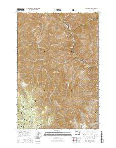
~ Deadhorse Ridge OR topo map, 1:24000 scale, 7.5 X 7.5 Minute, Current, 2014
Deadhorse Ridge, Oregon, USGS topographic map dated 2014.
Includes geographic coordinates (latitude and longitude). This topographic map is suitable for hiking, camping, and exploring, or framing it as a wall map.
Printed on-demand using high resolution imagery, on heavy weight and acid free paper, or alternatively on a variety of synthetic materials.
Topos available on paper, Waterproof, Poly, or Tyvek. Usually shipping rolled, unless combined with other folded maps in one order.
- Product Number: USGS-7259177
- Free digital map download (high-resolution, GeoPDF): Deadhorse Ridge, Oregon (file size: 33 MB)
- Map Size: please refer to the dimensions of the GeoPDF map above
- Weight (paper map): ca. 55 grams
- Map Type: POD USGS Topographic Map
- Map Series: US Topo
- Map Verison: Current
- Cell ID: 11593
- Datum: North American Datum of 1983
- Map Projection: Transverse Mercator
- Map Cell Name: Deadhorse Ridge
- Grid size: 7.5 X 7.5 Minute
- Date on map: 2014
- Map Scale: 1:24000
- Geographical region: Oregon, United States
Neighboring Maps:
All neighboring USGS topo maps are available for sale online at a variety of scales.
Spatial coverage:
Topo map Deadhorse Ridge, Oregon, covers the geographical area associated the following places:
- Pileup Creek - Imnaha Rapids - Deadhorse Butte - Mountain Sheep Creek - Cemetery Ridge - Deadhorse Spring - Vance Draw - Deadhorse Ridge - Buckhorn Lookout - Eureka Post Office (historical) - Experiment Creek - Mountain Sheep Rapids - Toomey Gulch - Mountain Chief Mine - Old Man Creek - Lightning Creek - Makin Creek - Eureka Creek Cabin - Buckhorn Spring - Imnaha River - Eureka (historical) - Dobbin Cabin - Spain Saddle - Chalk Creek - Tulley Creek Ranch - Bear Creek Rapids - Trough Gulch - Eureka Bar - Footbridge Mine - Salmon River - Mabel L Mine - Buckhorn Recreation Site - Knight Creek - Hilliker Gulch - Eureka Creek - Bonnie Doone Number One Mine - Edna Mine - Rustler Mine - First Creek - Lightning Post Office (historical) - Clemons Place - Cherry Creek Ranch - Cow Creek
- Map Area ID: AREA45.87545.75-116.875-116.75
- Northwest corner Lat/Long code: USGSNW45.875-116.875
- Northeast corner Lat/Long code: USGSNE45.875-116.75
- Southwest corner Lat/Long code: USGSSW45.75-116.875
- Southeast corner Lat/Long code: USGSSE45.75-116.75
- Northern map edge Latitude: 45.875
- Southern map edge Latitude: 45.75
- Western map edge Longitude: -116.875
- Eastern map edge Longitude: -116.75


