
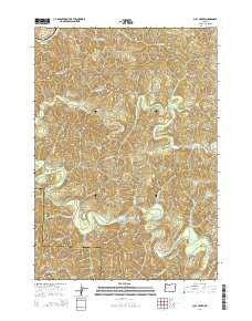
~ Clay Creek OR topo map, 1:24000 scale, 7.5 X 7.5 Minute, Current, 2014
Clay Creek, Oregon, USGS topographic map dated 2014.
Includes geographic coordinates (latitude and longitude). This topographic map is suitable for hiking, camping, and exploring, or framing it as a wall map.
Printed on-demand using high resolution imagery, on heavy weight and acid free paper, or alternatively on a variety of synthetic materials.
Topos available on paper, Waterproof, Poly, or Tyvek. Usually shipping rolled, unless combined with other folded maps in one order.
- Product Number: USGS-7258839
- Free digital map download (high-resolution, GeoPDF): Clay Creek, Oregon (file size: 39 MB)
- Map Size: please refer to the dimensions of the GeoPDF map above
- Weight (paper map): ca. 55 grams
- Map Type: POD USGS Topographic Map
- Map Series: US Topo
- Map Verison: Current
- Cell ID: 8998
- Datum: North American Datum of 1983
- Map Projection: Transverse Mercator
- Map Cell Name: Clay Creek
- Grid size: 7.5 X 7.5 Minute
- Date on map: 2014
- Map Scale: 1:24000
- Geographical region: Oregon, United States
Neighboring Maps:
All neighboring USGS topo maps are available for sale online at a variety of scales.
Spatial coverage:
Topo map Clay Creek, Oregon, covers the geographical area associated the following places:
- Larue Creek - Siuslaw Guard Station - Haskins Creek - Johnson Creek - Joler (historical) - Edris Creek - Saleratus Creek - Mill Creek - Clay Creek Recreation Site - Bierce Creek - Pittenger Creek - Clay Creek Recreational Reservoir - Haight Creek Picnic Area - Farman Flat - Collins Creek - Van Curen Creek - Bill Lewis Creek - Fawn Creek - Burntwood Creek - Cougar Gulch - North Creek - Trail Creek - Wolf Creek - Trail Creek - Pugh Creek - Enfield (historical) - Layne Creek - Oat Creek - Fowler Creek - Gall Creek - Lick Creek - Clay Creek
- Map Area ID: AREA4443.875-123.625-123.5
- Northwest corner Lat/Long code: USGSNW44-123.625
- Northeast corner Lat/Long code: USGSNE44-123.5
- Southwest corner Lat/Long code: USGSSW43.875-123.625
- Southeast corner Lat/Long code: USGSSE43.875-123.5
- Northern map edge Latitude: 44
- Southern map edge Latitude: 43.875
- Western map edge Longitude: -123.625
- Eastern map edge Longitude: -123.5


