
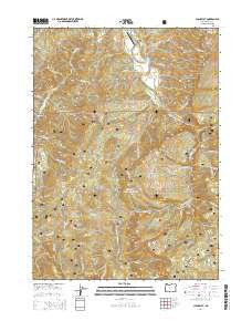
~ China Flat OR topo map, 1:24000 scale, 7.5 X 7.5 Minute, Current, 2014
China Flat, Oregon, USGS topographic map dated 2014.
Includes geographic coordinates (latitude and longitude). This topographic map is suitable for hiking, camping, and exploring, or framing it as a wall map.
Printed on-demand using high resolution imagery, on heavy weight and acid free paper, or alternatively on a variety of synthetic materials.
Topos available on paper, Waterproof, Poly, or Tyvek. Usually shipping rolled, unless combined with other folded maps in one order.
- Product Number: USGS-7258813
- Free digital map download (high-resolution, GeoPDF): China Flat, Oregon (file size: 39 MB)
- Map Size: please refer to the dimensions of the GeoPDF map above
- Weight (paper map): ca. 55 grams
- Map Type: POD USGS Topographic Map
- Map Series: US Topo
- Map Verison: Current
- Cell ID: 8574
- Datum: North American Datum of 1983
- Map Projection: Transverse Mercator
- Map Cell Name: China Flat
- Grid size: 7.5 X 7.5 Minute
- Date on map: 2014
- Map Scale: 1:24000
- Geographical region: Oregon, United States
Neighboring Maps:
All neighboring USGS topo maps are available for sale online at a variety of scales.
Spatial coverage:
Topo map China Flat, Oregon, covers the geographical area associated the following places:
- Orchard Park Boat Launch - Blue Creek - Whitewash Creek - Johnson Mountain - Boulder Creek - Tunnel Creek - Elk Creek Falls Recreation Site - Laird Creek - Lower Land Creek - Sand Rock Mountain - Rural Post Office (historical) - Jim Hayes Creek - China Flat - South Fork Elk Creek - Boundary Picnic Ground - Two by Four Creek - China Flat Campground - McCurdy Creek - Powers Airport - Hall Creek - Hickey Creek - Sucker Creek - Coal Creek Campground - Grant Creek - Elk Creek - Saddle A - Upper Land Creek - China Creek - Hayes Creek - Delta Creek - Hayes Cemetery - Fuzzy Gulch - Kelly Creek - Estes Creek - Slide Creek - Dry Creek - Powers City Park - Ragsdale Creek - Coal Creek - North Fork Elk Creek - Elk Creek Falls - Pyburn Creek - Cedar Swamp - Bedrock Creek - Pole Creek - Gurkin Creek - Poverty Gulch - Waterpipe Creek - Powers Division - Sand Rock Creek - Norris Family Cemetery - Deer Creek - Boundary Campground - Myrtle Grove Recreation Site - Johnson Creek - Woodby Mountain - Bonner Creek - Flannigan Prairie - Big Tree Campground
- Map Area ID: AREA42.87542.75-124.125-124
- Northwest corner Lat/Long code: USGSNW42.875-124.125
- Northeast corner Lat/Long code: USGSNE42.875-124
- Southwest corner Lat/Long code: USGSSW42.75-124.125
- Southeast corner Lat/Long code: USGSSE42.75-124
- Northern map edge Latitude: 42.875
- Southern map edge Latitude: 42.75
- Western map edge Longitude: -124.125
- Eastern map edge Longitude: -124


