
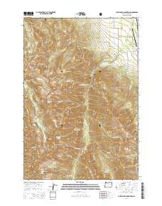
~ Chief Joseph Mountain OR topo map, 1:24000 scale, 7.5 X 7.5 Minute, Current, 2014
Chief Joseph Mountain, Oregon, USGS topographic map dated 2014.
Includes geographic coordinates (latitude and longitude). This topographic map is suitable for hiking, camping, and exploring, or framing it as a wall map.
Printed on-demand using high resolution imagery, on heavy weight and acid free paper, or alternatively on a variety of synthetic materials.
Topos available on paper, Waterproof, Poly, or Tyvek. Usually shipping rolled, unless combined with other folded maps in one order.
- Product Number: USGS-7258803
- Free digital map download (high-resolution, GeoPDF): Chief Joseph Mountain, Oregon (file size: 36 MB)
- Map Size: please refer to the dimensions of the GeoPDF map above
- Weight (paper map): ca. 55 grams
- Map Type: POD USGS Topographic Map
- Map Series: US Topo
- Map Verison: Current
- Cell ID: 8505
- Datum: North American Datum of 1983
- Map Projection: Transverse Mercator
- Map Cell Name: Chief Joseph Mountain
- Grid size: 7.5 X 7.5 Minute
- Date on map: 2014
- Map Scale: 1:24000
- Geographical region: Oregon, United States
Neighboring Maps:
All neighboring USGS topo maps are available for sale online at a variety of scales.
Spatial coverage:
Topo map Chief Joseph Mountain, Oregon, covers the geographical area associated the following places:
- Granite Meadow - Chief Joseph Mountain - Hurricane Ditch - Granite Creek - Billy Jones Creek - Miners Basin - Thorp Creek - Hurricane Creek Recreation Site - Silver Grange Ditch - Hurricane Creek Trailhead - Francis Lake - Joseph Cemetery - Joseph State Airport - Hurricane Grange - Murray Saddle - Twin Peaks - Spring Creek - Hurricane Divide - Sawtooth Peak - Consolidated Ditch - Hurricane Rapids - Falls Creek Forest Camp - Mill Creek - Dunn Creek - Legore Lake - Deadman Creek - Point Joseph - Traverse Ridge - Deadman Lake - Hurwal Divide - Joseph Mountain Mines - Little Granite Creek - Ruby Peak - Slick Rock Creek - Newby Creek - Hurricane Point - Falls Creek - Billy Jones Lake - Twin Creek - Legore Mine - Echo Lake
- Map Area ID: AREA45.37545.25-117.375-117.25
- Northwest corner Lat/Long code: USGSNW45.375-117.375
- Northeast corner Lat/Long code: USGSNE45.375-117.25
- Southwest corner Lat/Long code: USGSSW45.25-117.375
- Southeast corner Lat/Long code: USGSSE45.25-117.25
- Northern map edge Latitude: 45.375
- Southern map edge Latitude: 45.25
- Western map edge Longitude: -117.375
- Eastern map edge Longitude: -117.25


