
~ Cape Blanco OR topo map, 1:24000 scale, 7.5 X 7.5 Minute, Current, 2014
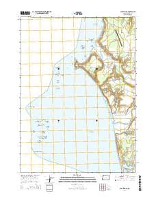
Cape Blanco, Oregon, USGS topographic map dated 2014.
Includes geographic coordinates (latitude and longitude). This topographic map is suitable for hiking, camping, and exploring, or framing it as a wall map.
Printed on-demand using high resolution imagery, on heavy weight and acid free paper, or alternatively on a variety of synthetic materials.
Topos available on paper, Waterproof, Poly, or Tyvek. Usually shipping rolled, unless combined with other folded maps in one order.
- Product Number: USGS-7258743
- Free digital map download (high-resolution, GeoPDF): Cape Blanco, Oregon (file size: 32 MB)
- Map Size: please refer to the dimensions of the GeoPDF map above
- Weight (paper map): ca. 55 grams
- Map Type: POD USGS Topographic Map
- Map Series: US Topo
- Map Verison: Current
- Cell ID: 7158
- Datum: North American Datum of 1983
- Map Projection: Transverse Mercator
- Map Cell Name: Cape Blanco
- Grid size: 7.5 X 7.5 Minute
- Date on map: 2014
- Map Scale: 1:24000
- Geographical region: Oregon, United States
Neighboring Maps:
All neighboring USGS topo maps are available for sale online at a variety of scales.
Spatial coverage:
Topo map Cape Blanco, Oregon, covers the geographical area associated the following places:
- Cape Blanco Mine - Cape Blanco State Airport - Buffington Memorial Park - Port Orford Water Treatment Plant - Cape Blanco Lighthouse - Large Brown Rock - Garrison Lake - Tseriadum State Park - Sixes Beach - Cape Blanco - Square White Rock - Northwest Rock - Steamboat Rock - Long Brown Rock - Castle Rock - Arch Rock - Historic Patrick Hughes House - Flat Rock - Squaw Bluff - Cape Blanco Lighthouse - Best Rock - Blanco Reef - Southeast Black Rock - Pyramid Rock - Cape Blanco State Park - West Conical Rock - Barrel Rock - Paradise Point State Park - Orford Reef - Split Rock - Elk River - Sixes River - Needle Rock - Tituna Spit - Conical White Rock - Floras Lake State Park - Gull Rock - Black Rock - Seal Rock - Seaforth Post Office (historical) - Flat Black Rock - Hughes Family Cemetery - Cape Blanco State Park Boat Ramp - Mill Creek
- Map Area ID: AREA42.87542.75-124.625-124.5
- Northwest corner Lat/Long code: USGSNW42.875-124.625
- Northeast corner Lat/Long code: USGSNE42.875-124.5
- Southwest corner Lat/Long code: USGSSW42.75-124.625
- Southeast corner Lat/Long code: USGSSE42.75-124.5
- Northern map edge Latitude: 42.875
- Southern map edge Latitude: 42.75
- Western map edge Longitude: -124.625
- Eastern map edge Longitude: -124.5


