
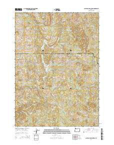
~ Calf Ranch Mountain OR topo map, 1:24000 scale, 7.5 X 7.5 Minute, Current, 2014
Calf Ranch Mountain, Oregon, USGS topographic map dated 2014.
Includes geographic coordinates (latitude and longitude). This topographic map is suitable for hiking, camping, and exploring, or framing it as a wall map.
Printed on-demand using high resolution imagery, on heavy weight and acid free paper, or alternatively on a variety of synthetic materials.
Topos available on paper, Waterproof, Poly, or Tyvek. Usually shipping rolled, unless combined with other folded maps in one order.
- Product Number: USGS-7258717
- Free digital map download (high-resolution, GeoPDF): Calf Ranch Mountain, Oregon (file size: 36 MB)
- Map Size: please refer to the dimensions of the GeoPDF map above
- Weight (paper map): ca. 55 grams
- Map Type: POD USGS Topographic Map
- Map Series: US Topo
- Map Verison: Current
- Cell ID: 6723
- Datum: North American Datum of 1983
- Map Projection: Transverse Mercator
- Map Cell Name: Calf Ranch Mountain
- Grid size: 7.5 X 7.5 Minute
- Date on map: 2014
- Map Scale: 1:24000
- Geographical region: Oregon, United States
Neighboring Maps:
All neighboring USGS topo maps are available for sale online at a variety of scales.
Spatial coverage:
Topo map Calf Ranch Mountain, Oregon, covers the geographical area associated the following places:
- North Fourmile Creek - Hare (historical) - Camp Fir Croft - Doe Camp - Triangle Post Office (historical) - Horner Creek - White Elephant Bridge - Cotton Butte - Calf Ranch Mountain - Watches Butte - Little Edson Butte - North Fork Floras Creek - Bennett Butte - West Fork Floras Creek - Bennett Post Office (historical) - Williams Creek - Ocean View Cemetery - Okietown - South Fork Floras Creek - Huff Creek - Buzzard Butte Canyon - Hare Post Office (historical) - East Fork Floras Creek - Guerin Creek - White Rock - Little Creek - Dwyer Creek - Oberg Canyon - Crutchfield Creek - Calf Ranch Prairie - Buzzard Butte
- Map Area ID: AREA4342.875-124.375-124.25
- Northwest corner Lat/Long code: USGSNW43-124.375
- Northeast corner Lat/Long code: USGSNE43-124.25
- Southwest corner Lat/Long code: USGSSW42.875-124.375
- Southeast corner Lat/Long code: USGSSE42.875-124.25
- Northern map edge Latitude: 43
- Southern map edge Latitude: 42.875
- Western map edge Longitude: -124.375
- Eastern map edge Longitude: -124.25


