
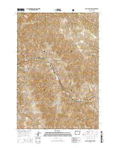
~ Cactus Mountain OR topo map, 1:24000 scale, 7.5 X 7.5 Minute, Current, 2014
Cactus Mountain, Oregon, USGS topographic map dated 2014.
Includes geographic coordinates (latitude and longitude). This topographic map is suitable for hiking, camping, and exploring, or framing it as a wall map.
Printed on-demand using high resolution imagery, on heavy weight and acid free paper, or alternatively on a variety of synthetic materials.
Topos available on paper, Waterproof, Poly, or Tyvek. Usually shipping rolled, unless combined with other folded maps in one order.
- Product Number: USGS-7258707
- Free digital map download (high-resolution, GeoPDF): Cactus Mountain, Oregon (file size: 32 MB)
- Map Size: please refer to the dimensions of the GeoPDF map above
- Weight (paper map): ca. 55 grams
- Map Type: POD USGS Topographic Map
- Map Series: US Topo
- Map Verison: Current
- Cell ID: 6613
- Datum: North American Datum of 1983
- Map Projection: Transverse Mercator
- Map Cell Name: Cactus Mountain
- Grid size: 7.5 X 7.5 Minute
- Date on map: 2014
- Map Scale: 1:24000
- Geographical region: Oregon, United States
Neighboring Maps:
All neighboring USGS topo maps are available for sale online at a variety of scales.
Spatial coverage:
Topo map Cactus Mountain, Oregon, covers the geographical area associated the following places:
- Boulder Rapids - Chinese Massacre Cove - Sugarloaf Knob - Robinson Gulch - Lone Pine Saddle - Thorn Spring Creek - Dry Creek Island - Brushy Canyon - Deep Creek Rapids - Spencer Ranch Landing Strip (historical) - Canaan Canyon - Sugarloaf Butte - Dog Creek - Dug Bar Recreation Site - Divide Creek - Dug Creek - Dug Bar - Little Deep Creek - Cow Creek Bridge - Trail Gulch - Deep Creek - Big Canyon - China Gulch - Mack Gulch - Whitehorse Rapids - Birch Creek - Robinson Gulch Rapids - Little Sulphur Creek - Dug Bar Boat Ramp - Cactus Mountain - Wyley Creek - Fence Gulch - Dry Point - Warm Springs Rapids - Pool Knob - Coyote Gulch - Camp Creek - Zigzag Creek - Dug Creek Rapids - China Creek - Spencer Ranch - Kane Gulch - Zigzag Rapids - Pool Gulch - Camp Creek - Divide Creek Rapids - Lower Dug Bar Rapids - Big Sulphur Creek - Doug Creek - Willow Spring - Big Sulphur Rapids - Dellas Peak
- Map Area ID: AREA45.87545.75-116.75-116.625
- Northwest corner Lat/Long code: USGSNW45.875-116.75
- Northeast corner Lat/Long code: USGSNE45.875-116.625
- Southwest corner Lat/Long code: USGSSW45.75-116.75
- Southeast corner Lat/Long code: USGSSE45.75-116.625
- Northern map edge Latitude: 45.875
- Southern map edge Latitude: 45.75
- Western map edge Longitude: -116.75
- Eastern map edge Longitude: -116.625


