
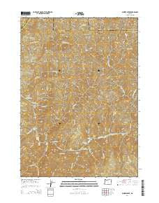
~ Bunker Creek OR topo map, 1:24000 scale, 7.5 X 7.5 Minute, Current, 2014
Bunker Creek, Oregon, USGS topographic map dated 2014.
Includes geographic coordinates (latitude and longitude). This topographic map is suitable for hiking, camping, and exploring, or framing it as a wall map.
Printed on-demand using high resolution imagery, on heavy weight and acid free paper, or alternatively on a variety of synthetic materials.
Topos available on paper, Waterproof, Poly, or Tyvek. Usually shipping rolled, unless combined with other folded maps in one order.
- Product Number: USGS-7258675
- Free digital map download (high-resolution, GeoPDF): Bunker Creek, Oregon (file size: 42 MB)
- Map Size: please refer to the dimensions of the GeoPDF map above
- Weight (paper map): ca. 55 grams
- Map Type: POD USGS Topographic Map
- Map Series: US Topo
- Map Verison: Current
- Cell ID: 6196
- Datum: North American Datum of 1983
- Map Projection: Transverse Mercator
- Map Cell Name: Bunker Creek
- Grid size: 7.5 X 7.5 Minute
- Date on map: 2014
- Map Scale: 1:24000
- Geographical region: Oregon, United States
Neighboring Maps:
All neighboring USGS topo maps are available for sale online at a variety of scales.
Spatial coverage:
Topo map Bunker Creek, Oregon, covers the geographical area associated the following places:
- Russian Creek Campground - Black Bar Lodge - Russian Rapids - Wildcat Campground - East Fork Big Windy Creek - Little Windy Creek - Whiskey Creek Campground - Illinois Valley Ranger Station - Whisky Creek - Whisky Creek Cabin - Windy Creek Chute - Trappers Camp - Dutch Henry Trail (historical) - Black Bar - Jenny Creek - Washboard Rapids - Tyee Bar - Wildcat Rapids - Big Slide Riffle - Reno Mine - Little Windy Riffle - Horse Range Camp (historical) - Big Windy Creek Campground - Bunker Creek - Big Windy Creek - Slim Pickins Rapid - West Fork Whisky Creek - East Fork Rum Creek - Francis Creek - Booze Creek - Cowley Creek - Little Windy Creek Campground - East Fork Whisky Creek - Horse Range - Montgomery Rapids - Alder Creek - Bronco Creek - Benton Mine - Lower Black Bar Falls - Meadow Camp - Wildcat Creek - Howard Creek Chute - Upper Black Bar Falls - Howard Creek - North Jenny Creek Campground - Shady Creek - Tyee Rapids - Drain Creek - Rum Creek - Plowshare Rapids - Big Slide Campground - Montgomery Creek - Whisky Creek Spring - Slate Slide Shelter (historical) - Copsey Creek - Slate Slide Riffle - Telephone Hole Riffle - Russian Creek - Meadow Creek - Horseshoe Bend Campground - Horseshoe Bend - Copsey Camp - Doe Creek Campground - Cool Spring - California Gulch
- Map Area ID: AREA42.7542.625-123.75-123.625
- Northwest corner Lat/Long code: USGSNW42.75-123.75
- Northeast corner Lat/Long code: USGSNE42.75-123.625
- Southwest corner Lat/Long code: USGSSW42.625-123.75
- Southeast corner Lat/Long code: USGSSE42.625-123.625
- Northern map edge Latitude: 42.75
- Southern map edge Latitude: 42.625
- Western map edge Longitude: -123.75
- Eastern map edge Longitude: -123.625


