
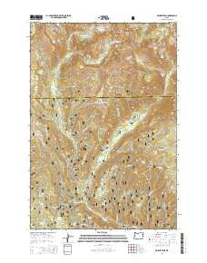
~ Bennet Peak OR topo map, 1:24000 scale, 7.5 X 7.5 Minute, Current, 2014
Bennet Peak, Oregon, USGS topographic map dated 2014.
Includes geographic coordinates (latitude and longitude). This topographic map is suitable for hiking, camping, and exploring, or framing it as a wall map.
Printed on-demand using high resolution imagery, on heavy weight and acid free paper, or alternatively on a variety of synthetic materials.
Topos available on paper, Waterproof, Poly, or Tyvek. Usually shipping rolled, unless combined with other folded maps in one order.
- Product Number: USGS-7258489
- Free digital map download (high-resolution, GeoPDF): Bennet Peak, Oregon (file size: 41 MB)
- Map Size: please refer to the dimensions of the GeoPDF map above
- Weight (paper map): ca. 55 grams
- Map Type: POD USGS Topographic Map
- Map Series: US Topo
- Map Verison: Current
- Cell ID: 3339
- Datum: North American Datum of 1983
- Map Projection: Transverse Mercator
- Map Cell Name: Bennet Peak
- Grid size: 7.5 X 7.5 Minute
- Date on map: 2014
- Map Scale: 1:24000
- Geographical region: Oregon, United States
Neighboring Maps:
All neighboring USGS topo maps are available for sale online at a variety of scales.
Spatial coverage:
Topo map Bennet Peak, Oregon, covers the geographical area associated the following places:
- Two Color Guard Station - Echo Lake - Two Color Recreation Site - Echo Lake Dam - Boulder Creek - Jenkins Spring - Boulder Park Resort (historical) - Fake Creek Trail - Groover Spring - Grove Creek - Heart Lake - Little Boulder Creek - Boulder Park Recreation Site - Skookum Creek - Two Color Horse Camp - Mammouth Spring - East Fork West Eagle Creek - Tamarack Recreation Site - Arrow Lake - West Eagle Creek - Eagleton Post Office (historical) - Jim Creek - Flat Rock Forest Camp - West Eagle Horse Camp - Bennett Peak - Forks Forest Camp - Cow Creek - Fake Creek - Basin Creek - Basin Mine - Cougar Meadows - Copper Creek - Lookout Spring - Mud Spring - West Eagle Meadow - Traverse Lake - Trail Creek Trail - Silver Spring - West Eagle Trail - Excelsior Gulch - Dixie Creek - Phillips Ditch - Steiger Spring - Olive Lake - Thistle Creek - Glendenning Creek - Traverse Lake Dam - Bench Canyon - Copper Creek Falls - Two Color Creek
- Map Area ID: AREA45.12545-117.5-117.375
- Northwest corner Lat/Long code: USGSNW45.125-117.5
- Northeast corner Lat/Long code: USGSNE45.125-117.375
- Southwest corner Lat/Long code: USGSSW45-117.5
- Southeast corner Lat/Long code: USGSSE45-117.375
- Northern map edge Latitude: 45.125
- Southern map edge Latitude: 45
- Western map edge Longitude: -117.5
- Eastern map edge Longitude: -117.375


