
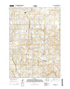
~ Bend Airport OR topo map, 1:24000 scale, 7.5 X 7.5 Minute, Current, 2014
Bend Airport, Oregon, USGS topographic map dated 2014.
Includes geographic coordinates (latitude and longitude). This topographic map is suitable for hiking, camping, and exploring, or framing it as a wall map.
Printed on-demand using high resolution imagery, on heavy weight and acid free paper, or alternatively on a variety of synthetic materials.
Topos available on paper, Waterproof, Poly, or Tyvek. Usually shipping rolled, unless combined with other folded maps in one order.
- Product Number: USGS-7258483
- Free digital map download (high-resolution, GeoPDF): Bend Airport, Oregon (file size: 34 MB)
- Map Size: please refer to the dimensions of the GeoPDF map above
- Weight (paper map): ca. 55 grams
- Map Type: POD USGS Topographic Map
- Map Series: US Topo
- Map Verison: Current
- Cell ID: 3310
- Datum: North American Datum of 1983
- Map Projection: Transverse Mercator
- Map Cell Name: Bend Airport
- Grid size: 7.5 X 7.5 Minute
- Date on map: 2014
- Map Scale: 1:24000
- Geographical region: Oregon, United States
Neighboring Maps:
All neighboring USGS topo maps are available for sale online at a variety of scales.
Spatial coverage:
Topo map Bend Airport, Oregon, covers the geographical area associated the following places:
- Young School (historical) - KBND-AM - Kennel Airstrip - Eastern Star Grange Hall - Bend Division - Big Sky Park and Sports Complex - Bend Wastewater Treatment Plant - Buckingham Elementary School - Lava Rock School (historical) - Mayfield Pond - Mercer (historical) - Bend Municipal Airport - City of Bend Fire Department Station 304 East Fire Station
- Map Area ID: AREA44.12544-121.25-121.125
- Northwest corner Lat/Long code: USGSNW44.125-121.25
- Northeast corner Lat/Long code: USGSNE44.125-121.125
- Southwest corner Lat/Long code: USGSSW44-121.25
- Southeast corner Lat/Long code: USGSSE44-121.125
- Northern map edge Latitude: 44.125
- Southern map edge Latitude: 44
- Western map edge Longitude: -121.25
- Eastern map edge Longitude: -121.125


