
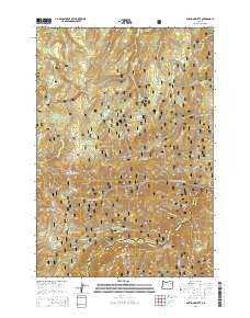
~ Anthony Butte OR topo map, 1:24000 scale, 7.5 X 7.5 Minute, Current, 2014
Anthony Butte, Oregon, USGS topographic map dated 2014.
Includes geographic coordinates (latitude and longitude). This topographic map is suitable for hiking, camping, and exploring, or framing it as a wall map.
Printed on-demand using high resolution imagery, on heavy weight and acid free paper, or alternatively on a variety of synthetic materials.
Topos available on paper, Waterproof, Poly, or Tyvek. Usually shipping rolled, unless combined with other folded maps in one order.
- Product Number: USGS-7258281
- Free digital map download (high-resolution, GeoPDF): Anthony Butte, Oregon (file size: 40 MB)
- Map Size: please refer to the dimensions of the GeoPDF map above
- Weight (paper map): ca. 55 grams
- Map Type: POD USGS Topographic Map
- Map Series: US Topo
- Map Verison: Current
- Cell ID: 1188
- Datum: North American Datum of 1983
- Map Projection: Transverse Mercator
- Map Cell Name: Anthony Butte
- Grid size: 7.5 X 7.5 Minute
- Date on map: 2014
- Map Scale: 1:24000
- Geographical region: Oregon, United States
Neighboring Maps:
All neighboring USGS topo maps are available for sale online at a variety of scales.
Spatial coverage:
Topo map Anthony Butte, Oregon, covers the geographical area associated the following places:
- High Summit Spring - Anthony Butte - Beaver Meadow - Beatty Creek - Porcupine Guard Station - Friday Meadow - Gorham Butte - Rocky Point - Boulevard Trail - Three Bucket Spring - North Fork Anthony Campground - La Grande Watershed - Marion Point - Sand Flats - High Mountain - Webfoot Creek - North Fork Anthony Creek - Indian Creek - Second Creek - Isham Spring - Webfoot Meadow - Elkhorn Creek - Bear Wallow Spring
- Map Area ID: AREA45.12545-118.25-118.125
- Northwest corner Lat/Long code: USGSNW45.125-118.25
- Northeast corner Lat/Long code: USGSNE45.125-118.125
- Southwest corner Lat/Long code: USGSSW45-118.25
- Southeast corner Lat/Long code: USGSSE45-118.125
- Northern map edge Latitude: 45.125
- Southern map edge Latitude: 45
- Western map edge Longitude: -118.25
- Eastern map edge Longitude: -118.125


