
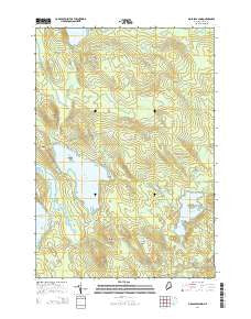
~ Molasses Pond ME topo map, 1:24000 scale, 7.5 X 7.5 Minute, 2014
Molasses Pond, Maine, USGS topographic map dated 2014.
Includes geographic coordinates (latitude and longitude). This topographic map is suitable for hiking, camping, and exploring, or framing it as a wall map.
Printed on-demand using high resolution imagery, on heavy weight and acid free paper, or alternatively on a variety of synthetic materials.
Topos available on paper, Waterproof, Poly, or Tyvek. Usually shipping rolled, unless combined with other folded maps in one order.
- Product Number: USGS-7256796
- Free digital map download (high-resolution, GeoPDF): Molasses Pond, Maine (file size: 27 MB)
- Map Size: please refer to the dimensions of the GeoPDF map above
- Weight (paper map): ca. 55 grams
- Map Type: POD USGS Topographic Map
- Map Series: US Topo
- Map Verison: Current
- Cell ID: 29783
- Datum: North American Datum of 1983
- Map Projection: Transverse Mercator
- Map Cell Name: Molasses Pond
- Grid size: 7.5 X 7.5 Minute
- Date on map: 2014
- Map Scale: 1:24000
- Geographical region: Maine, United States
Neighboring Maps:
All neighboring USGS topo maps are available for sale online at a variety of scales.
Spatial coverage:
Topo map Molasses Pond, Maine, covers the geographical area associated the following places:
- Clark Meadow - Crimmins Cemetery - Chez Vent - Little Bull Hill - Bull Hill - Sparrow Hill - Butler Cove - Beech Knoll - Roaring Brook - Oxbow Heath - Hooper Heath - Hardwood Hill - Macomber Mill Stream - Frenchs Dam Meadow - The Oxbow - Molasses Pond Boat Launch - Otter Bog - Mud Brook Ridge - Martin Ridge - Abrams Pond - Scammon Pond - Myrick Ridge - Lyle Frost Wildlife Management Area - Town of Eastbrook - Crimmins Island - Deep Cove - Little Hardwood Hill - Scammon Pond - Clark Meadow Brook - Clark Pond - Mill Stream Heath - Birch Hill - Molasses Pond - Austins Dam Heath - Sams Heath - Sugar Hill - Heifer Hill - Neck Ridge
- Map Area ID: AREA44.7544.625-68.25-68.125
- Northwest corner Lat/Long code: USGSNW44.75-68.25
- Northeast corner Lat/Long code: USGSNE44.75-68.125
- Southwest corner Lat/Long code: USGSSW44.625-68.25
- Southeast corner Lat/Long code: USGSSE44.625-68.125
- Northern map edge Latitude: 44.75
- Southern map edge Latitude: 44.625
- Western map edge Longitude: -68.25
- Eastern map edge Longitude: -68.125


