
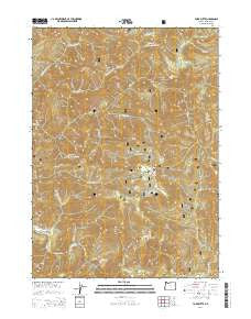
~ York Butte OR topo map, 1:24000 scale, 7.5 X 7.5 Minute, Current, 2014
York Butte, Oregon, USGS topographic map dated 2014.
Includes geographic coordinates (latitude and longitude). This topographic map is suitable for hiking, camping, and exploring, or framing it as a wall map.
Printed on-demand using high resolution imagery, on heavy weight and acid free paper, or alternatively on a variety of synthetic materials.
Topos available on paper, Waterproof, Poly, or Tyvek. Usually shipping rolled, unless combined with other folded maps in one order.
- Product Number: USGS-7255396
- Free digital map download (high-resolution, GeoPDF): York Butte, Oregon (file size: 40 MB)
- Map Size: please refer to the dimensions of the GeoPDF map above
- Weight (paper map): ca. 55 grams
- Map Type: POD USGS Topographic Map
- Map Series: US Topo
- Map Verison: Current
- Cell ID: 72598
- Datum: North American Datum of 1983
- Map Projection: Transverse Mercator
- Map Cell Name: York Butte
- Grid size: 7.5 X 7.5 Minute
- Date on map: 2014
- Map Scale: 1:24000
- Geographical region: Oregon, United States
Neighboring Maps:
All neighboring USGS topo maps are available for sale online at a variety of scales.
Spatial coverage:
Topo map York Butte, Oregon, covers the geographical area associated the following places:
- York Creek - Old Glory Mine - Pine Creek Shelter (historical) - Moon Creek - Brushy Bar - Silver Falls - Soldier Creek - Hayden Creek - East Fork Pine Creek - Clear Creek - Little Silver Creek - Chinaman Hat - Pine Flat - Briggs Creek Recreation Site - Mud Springs - Trail Canyon - Panther Bar - Todd Creek - Flat Top - Lake Creek - Dorr Canyon - Briggs Creek - Pine Creek - Nobles House - Little Silver Creek Lake - Chance Creek - Dasher Meadow - Rawhide Creek - Red Dog Creek - York Creek Botanical Area - Phillips Creek - Weaver Ranch (historical) - Little Todd Creek - West Fork Pine Creek - Panther Creek - York Butte
- Map Area ID: AREA42.542.375-123.875-123.75
- Northwest corner Lat/Long code: USGSNW42.5-123.875
- Northeast corner Lat/Long code: USGSNE42.5-123.75
- Southwest corner Lat/Long code: USGSSW42.375-123.875
- Southeast corner Lat/Long code: USGSSE42.375-123.75
- Northern map edge Latitude: 42.5
- Southern map edge Latitude: 42.375
- Western map edge Longitude: -123.875
- Eastern map edge Longitude: -123.75


