
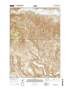
~ Wendt Butte OR topo map, 1:24000 scale, 7.5 X 7.5 Minute, Current, 2014
Wendt Butte, Oregon, USGS topographic map dated 2014.
Includes geographic coordinates (latitude and longitude). This topographic map is suitable for hiking, camping, and exploring, or framing it as a wall map.
Printed on-demand using high resolution imagery, on heavy weight and acid free paper, or alternatively on a variety of synthetic materials.
Topos available on paper, Waterproof, Poly, or Tyvek. Usually shipping rolled, unless combined with other folded maps in one order.
- Product Number: USGS-7255206
- Free digital map download (high-resolution, GeoPDF): Wendt Butte, Oregon (file size: 30 MB)
- Map Size: please refer to the dimensions of the GeoPDF map above
- Weight (paper map): ca. 55 grams
- Map Type: POD USGS Topographic Map
- Map Series: US Topo
- Map Verison: Current
- Cell ID: 48092
- Datum: North American Datum of 1983
- Map Projection: Transverse Mercator
- Map Cell Name: Wendt Butte
- Grid size: 7.5 X 7.5 Minute
- Date on map: 2014
- Map Scale: 1:24000
- Geographical region: Oregon, United States
Neighboring Maps:
All neighboring USGS topo maps are available for sale online at a variety of scales.
Spatial coverage:
Topo map Wendt Butte, Oregon, covers the geographical area associated the following places:
- McPherson Ditch - Miller Creek - Road Canyon - Glasgow Gulch - Clarks Creek Ditch - Cave Hollow Spring - Spring Gulch - Three Pine Butte - Wendt Gulch - Mill Ditch - Golden Eagle Mine - Indian Gulch - Cary Spring - Picnic Spring - Pole Gulch - Wendt Butte - Nickols Spring - Miller Flat - Lynns Ditch - Dry Gulch - Chicken Creek - West Fork Koontz Creek - Baldy Mountain - West Fork Stack Creek - Stack Creek - Dry Grouse Creek - Evans Gulch - McPherson Gulch - Koontz Creek - Mill Creek - Fish Creek - Mahogany Creek - Groundhog Gulch - West Fork Evans Gulch - Pole Gulch Reservoir - East Fork Evans Gulch - Elliot Ditch - Schofield Flat - Cornet Creek - Alder Creek - Rattlesnake Gulch - Mahogany Flat - Rockaby Creek - Cave Hollow - Shasta Gap - Porter Gulch - Lone Pine Gulch - McClellan Creek - Little Alder Creek - East Fork Koontz Creek - Clement Ditch
- Map Area ID: AREA44.544.375-117.875-117.75
- Northwest corner Lat/Long code: USGSNW44.5-117.875
- Northeast corner Lat/Long code: USGSNE44.5-117.75
- Southwest corner Lat/Long code: USGSSW44.375-117.875
- Southeast corner Lat/Long code: USGSSE44.375-117.75
- Northern map edge Latitude: 44.5
- Southern map edge Latitude: 44.375
- Western map edge Longitude: -117.875
- Eastern map edge Longitude: -117.75


