
~ Warner Mountain OR topo map, 1:24000 scale, 7.5 X 7.5 Minute, Current, 2014
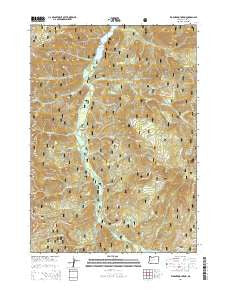
Warner Mountain, Oregon, USGS topographic map dated 2014.
Includes geographic coordinates (latitude and longitude). This topographic map is suitable for hiking, camping, and exploring, or framing it as a wall map.
Printed on-demand using high resolution imagery, on heavy weight and acid free paper, or alternatively on a variety of synthetic materials.
Topos available on paper, Waterproof, Poly, or Tyvek. Usually shipping rolled, unless combined with other folded maps in one order.
- Product Number: USGS-7255186
- Free digital map download (high-resolution, GeoPDF): Warner Mountain, Oregon (file size: 39 MB)
- Map Size: please refer to the dimensions of the GeoPDF map above
- Weight (paper map): ca. 55 grams
- Map Type: POD USGS Topographic Map
- Map Series: US Topo
- Map Verison: Current
- Cell ID: 47495
- Datum: North American Datum of 1983
- Map Projection: Transverse Mercator
- Map Cell Name: Warner Mountain
- Grid size: 7.5 X 7.5 Minute
- Date on map: 2014
- Map Scale: 1:24000
- Geographical region: Oregon, United States
Neighboring Maps:
All neighboring USGS topo maps are available for sale online at a variety of scales.
Spatial coverage:
Topo map Warner Mountain, Oregon, covers the geographical area associated the following places:
- Estep Creek - Moon Lake - Butcherknife Creek - Pine Creek - Secret Recreation Site - Coal Creek - Fir Creek - Cone Creek - Sand Prairie - Snake Creek - Jims Creek - Cynosure Forest Camp (historical) - Moon Lake Trail - Rocky Point Way - Youngs Rock - Moon Point - Coffeepot Creek - Tea Creek - Dry Creek - Youngs Creek - Bingham Boat Ramp - Deadhorse Creek - South Fork Buck Creek - Bohemia Creek - Sand Prairie Recreation Site - North Fork Indian Creek - Snow Creek - Emile Creek - Campers Flat Recreation Site - Spring Butte - North Fork Buck Creek - Bills Creek - Boulder Creek - Noon Creek - Stone Mountain - Spring Butte Creek - Powder Creek - Moon Lake Shelter - Windfall Creek - Indian Creek - Warner Mountain - Bingham Recreation Site - What Creek - Buck Creek - Gold Creek - Grass Mountain Trail - Little Pine Openings - Croft Forest Camp (historical)
- Map Area ID: AREA43.62543.5-122.5-122.375
- Northwest corner Lat/Long code: USGSNW43.625-122.5
- Northeast corner Lat/Long code: USGSNE43.625-122.375
- Southwest corner Lat/Long code: USGSSW43.5-122.5
- Southeast corner Lat/Long code: USGSSE43.5-122.375
- Northern map edge Latitude: 43.625
- Southern map edge Latitude: 43.5
- Western map edge Longitude: -122.5
- Eastern map edge Longitude: -122.375


