
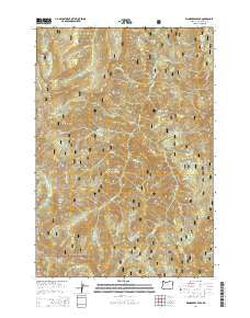
~ Wanderers Peak OR topo map, 1:24000 scale, 7.5 X 7.5 Minute, Current, 2014
Wanderers Peak, Oregon, USGS topographic map dated 2014.
Includes geographic coordinates (latitude and longitude). This topographic map is suitable for hiking, camping, and exploring, or framing it as a wall map.
Printed on-demand using high resolution imagery, on heavy weight and acid free paper, or alternatively on a variety of synthetic materials.
Topos available on paper, Waterproof, Poly, or Tyvek. Usually shipping rolled, unless combined with other folded maps in one order.
- Product Number: USGS-7255172
- Free digital map download (high-resolution, GeoPDF): Wanderers Peak, Oregon (file size: 37 MB)
- Map Size: please refer to the dimensions of the GeoPDF map above
- Weight (paper map): ca. 55 grams
- Map Type: POD USGS Topographic Map
- Map Series: US Topo
- Map Verison: Current
- Cell ID: 47406
- Datum: North American Datum of 1983
- Map Projection: Transverse Mercator
- Map Cell Name: Wanderers Peak
- Grid size: 7.5 X 7.5 Minute
- Date on map: 2014
- Map Scale: 1:24000
- Geographical region: Oregon, United States
Neighboring Maps:
All neighboring USGS topo maps are available for sale online at a variety of scales.
Spatial coverage:
Topo map Wanderers Peak, Oregon, covers the geographical area associated the following places:
- Dead Horse Butte - Big Meadow Quarry - Oasis Creek - South Fork Mountain - Deadhorse Quarry - Third Creek - Wear Creek - Wanderers Peak - Bracket Mountain Quarry - Flannel Creek - Camelsback - Dunharrow Quarry - First Creek - Lunch Creek - Calico Creek - Cotton Creek - Tweed Creek - Cedar Creek - Shovel Creek - Wash Creek - Worsted Creek - Fall Creek - Button Creek - Round Mountain - Silk Creek - Divide Butte - Gingham Creek - Music Creek - Second Creek - Wash Creek Butte - Trout Creek Quarry - Fish Creek Saddle Quarry - Pick Creek - Whalehead Quarry - Wanderers Creek - Bracket Mountain - Surprise Lake - Miners Butte - East Mountain - Memaloose Lake - Wool Creek - Coffee Creek - Calico Quarry
- Map Area ID: AREA45.12545-122.25-122.125
- Northwest corner Lat/Long code: USGSNW45.125-122.25
- Northeast corner Lat/Long code: USGSNE45.125-122.125
- Southwest corner Lat/Long code: USGSSW45-122.25
- Southeast corner Lat/Long code: USGSSE45-122.125
- Northern map edge Latitude: 45.125
- Southern map edge Latitude: 45
- Western map edge Longitude: -122.25
- Eastern map edge Longitude: -122.125


