
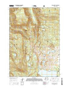
~ Waldo Mountain OR topo map, 1:24000 scale, 7.5 X 7.5 Minute, Current, 2014
Waldo Mountain, Oregon, USGS topographic map dated 2014.
Includes geographic coordinates (latitude and longitude). This topographic map is suitable for hiking, camping, and exploring, or framing it as a wall map.
Printed on-demand using high resolution imagery, on heavy weight and acid free paper, or alternatively on a variety of synthetic materials.
Topos available on paper, Waterproof, Poly, or Tyvek. Usually shipping rolled, unless combined with other folded maps in one order.
- Product Number: USGS-7255146
- Free digital map download (high-resolution, GeoPDF): Waldo Mountain, Oregon (file size: 38 MB)
- Map Size: please refer to the dimensions of the GeoPDF map above
- Weight (paper map): ca. 55 grams
- Map Type: POD USGS Topographic Map
- Map Series: US Topo
- Map Verison: Current
- Cell ID: 47231
- Datum: North American Datum of 1983
- Map Projection: Transverse Mercator
- Map Cell Name: Waldo Mountain
- Grid size: 7.5 X 7.5 Minute
- Date on map: 2014
- Map Scale: 1:24000
- Geographical region: Oregon, United States
Neighboring Maps:
All neighboring USGS topo maps are available for sale online at a variety of scales.
Spatial coverage:
Topo map Waldo Mountain, Oregon, covers the geographical area associated the following places:
- Islet Point - Round Lake - Long Lake - Otter Lake - Winchester Trail - Whig Lake - Torrey Lake - Harvey Lake - Ernie Lake - Quinn Lakes - Lower Quinn Lake - Dans Lake - Skookum Creek Recreation Site - Mickey Lake - Taylor Burn - Moolack Flat - Taylor Burn Recreation Site - Upper Erma Bell Lake - Mud Lake - Skookum Lake - Skookum Creek - Wahanna Lake - Waldo Meadows - Edna Lake - North Waldo Recreation Site - Waldo Lake Wilderness - Cervus Lake - Williams Lake - Lower Salmon Lake - Eddeeleo Lakes - Upper Rigdon Lake - Moolack Lake - Conim Lake - Waldo Meadows Guard Station - Middle Erma Bell Lake - Lower Eddeeleo Lake - Taylor Butte - Lower Rigdon Lake - Helen Lake - North Torrey Lake - Rigdon Butte - East Quinn Lake - North Waldo Boat Ramp - Swan Lake - Winchester Lake - Erma Bell Lakes - Taylor Burn Guard Station - Moolack Mountain - Lake Chetlo - Lower Erma Bell Lake - Salmon Lakes - Emma Lake - Upper Eddeeleo Lake - Winchester Forest Camp (historical) - Eastern Brook Lake - Brittany Lake - Upper Quinn Lake - Gander Lake - Lake Kiwa - Billy Lake - Upper Salmon Lake - Waldo Mountain - Gosling Lakes - Fields Lake
- Map Area ID: AREA43.87543.75-122.125-122
- Northwest corner Lat/Long code: USGSNW43.875-122.125
- Northeast corner Lat/Long code: USGSNE43.875-122
- Southwest corner Lat/Long code: USGSSW43.75-122.125
- Southeast corner Lat/Long code: USGSSE43.75-122
- Northern map edge Latitude: 43.875
- Southern map edge Latitude: 43.75
- Western map edge Longitude: -122.125
- Eastern map edge Longitude: -122


