
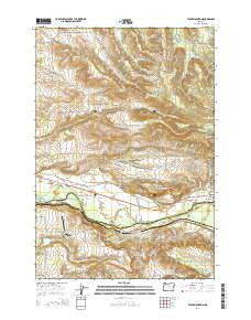
~ Stout Mountain OR topo map, 1:24000 scale, 7.5 X 7.5 Minute, Current, 2014
Stout Mountain, Oregon, USGS topographic map dated 2014.
Includes geographic coordinates (latitude and longitude). This topographic map is suitable for hiking, camping, and exploring, or framing it as a wall map.
Printed on-demand using high resolution imagery, on heavy weight and acid free paper, or alternatively on a variety of synthetic materials.
Topos available on paper, Waterproof, Poly, or Tyvek. Usually shipping rolled, unless combined with other folded maps in one order.
- Product Number: USGS-7254750
- Free digital map download (high-resolution, GeoPDF): Stout Mountain, Oregon (file size: 33 MB)
- Map Size: please refer to the dimensions of the GeoPDF map above
- Weight (paper map): ca. 55 grams
- Map Type: POD USGS Topographic Map
- Map Series: US Topo
- Map Verison: Current
- Cell ID: 43385
- Datum: North American Datum of 1983
- Map Projection: Transverse Mercator
- Map Cell Name: Stout Mountain
- Grid size: 7.5 X 7.5 Minute
- Date on map: 2014
- Map Scale: 1:24000
- Geographical region: Oregon, United States
Neighboring Maps:
All neighboring USGS topo maps are available for sale online at a variety of scales.
Spatial coverage:
Topo map Stout Mountain, Oregon, covers the geographical area associated the following places:
- Smith Creek - Kinsey Reservoir - Stayton Rural Fire Protection District Mehama Station - Williams (historical) - South Burn Guard Station - Horn Airport - Pietrock Cemetery - North Fork Mill Creek - Alder Creek Reservoir - Stout Creek - Silver Falls City (historical) - Coon Hollow - Tietz Hill - South Fork Valentine Creek - Mehama Census Designated Place - Mount Pleasant Post Office (historical) - Tietz Creek - South Fork Mill Creek - Mount Pleasant Cemetery - Upper Bennett Dam - King (historical) - Silver Falls State Park - Howard Creek - Smith Creek Youth Camp - North Fork Valentine Creek - Alder Creek - Park Campground - King Post Office (historical) - Fern Ridge - Siegmund Reservoir - Forbes (historical) - Mulkey Creek - Kiphart (historical) - Stout Mountain - Payne (historical) - Trask Creek - B F Goodlife Airstrip (historical) - Silver Falls Conference Center - Klumb Post Office (historical) - Kingston Airpark - Blacktail - Heater Reservoir
- Map Area ID: AREA44.87544.75-122.75-122.625
- Northwest corner Lat/Long code: USGSNW44.875-122.75
- Northeast corner Lat/Long code: USGSNE44.875-122.625
- Southwest corner Lat/Long code: USGSSW44.75-122.75
- Southeast corner Lat/Long code: USGSSE44.75-122.625
- Northern map edge Latitude: 44.875
- Southern map edge Latitude: 44.75
- Western map edge Longitude: -122.75
- Eastern map edge Longitude: -122.625


