
~ Stemler Ridge OR topo map, 1:24000 scale, 7.5 X 7.5 Minute, Current, 2014
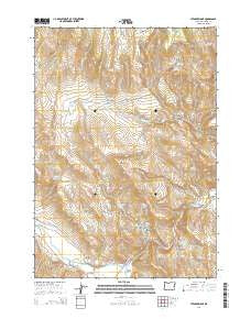
Stemler Ridge, Oregon, USGS topographic map dated 2014.
Includes geographic coordinates (latitude and longitude). This topographic map is suitable for hiking, camping, and exploring, or framing it as a wall map.
Printed on-demand using high resolution imagery, on heavy weight and acid free paper, or alternatively on a variety of synthetic materials.
Topos available on paper, Waterproof, Poly, or Tyvek. Usually shipping rolled, unless combined with other folded maps in one order.
- Product Number: USGS-7254732
- Free digital map download (high-resolution, GeoPDF): Stemler Ridge, Oregon (file size: 31 MB)
- Map Size: please refer to the dimensions of the GeoPDF map above
- Weight (paper map): ca. 55 grams
- Map Type: POD USGS Topographic Map
- Map Series: US Topo
- Map Verison: Current
- Cell ID: 43087
- Datum: North American Datum of 1983
- Map Projection: Transverse Mercator
- Map Cell Name: Stemler Ridge
- Grid size: 7.5 X 7.5 Minute
- Date on map: 2014
- Map Scale: 1:24000
- Geographical region: Oregon, United States
Neighboring Maps:
All neighboring USGS topo maps are available for sale online at a variety of scales.
Spatial coverage:
Topo map Stemler Ridge, Oregon, covers the geographical area associated the following places:
- Stemler Basin - Tunnel Reservoir - Poverty Spring - Boulder Spring - Cave Canyon - Mustang Basin - Calf Creek Waterhole - Juntura Valley - Horseshoe Bend - Juntura Investment Company Canal - Dishrag Spring - Dishrag Canyon - Beulah Creek Reservoir - Currey Canyon - Boney Basin Reservoir - Stemler Ridge Reservoir - Beulah Butte - Boney Basin - Dugout Creek - Currey Reservoir - Lake Ridge - Grasshopper Flat - Horseshoe Bend Spring - North Fork Malheur River - Beulah Creek - Forest Reservoir - Stemler Ridge - Gwynn Bridge - Joyce Reservoir - Hunter Creek - Dugout Reservoir - Boulder Spring Number 2 - Adobe Reservoir - Juniper Gulch - Currey Canyon Reservoir - Harris Reservoir - Horseshoe Bend Bridge - Lake Spring - Warm Spring - Red Willow Spring - Gwinn (historical)
- Map Area ID: AREA43.87543.75-118.125-118
- Northwest corner Lat/Long code: USGSNW43.875-118.125
- Northeast corner Lat/Long code: USGSNE43.875-118
- Southwest corner Lat/Long code: USGSSW43.75-118.125
- Southeast corner Lat/Long code: USGSSE43.75-118
- Northern map edge Latitude: 43.875
- Southern map edge Latitude: 43.75
- Western map edge Longitude: -118.125
- Eastern map edge Longitude: -118


