
~ Sparta Butte OR topo map, 1:24000 scale, 7.5 X 7.5 Minute, Current, 2014
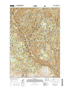
Sparta Butte, Oregon, USGS topographic map dated 2014.
Includes geographic coordinates (latitude and longitude). This topographic map is suitable for hiking, camping, and exploring, or framing it as a wall map.
Printed on-demand using high resolution imagery, on heavy weight and acid free paper, or alternatively on a variety of synthetic materials.
Topos available on paper, Waterproof, Poly, or Tyvek. Usually shipping rolled, unless combined with other folded maps in one order.
- Product Number: USGS-7254598
- Free digital map download (high-resolution, GeoPDF): Sparta Butte, Oregon (file size: 40 MB)
- Map Size: please refer to the dimensions of the GeoPDF map above
- Weight (paper map): ca. 55 grams
- Map Type: POD USGS Topographic Map
- Map Series: US Topo
- Map Verison: Current
- Cell ID: 42421
- Datum: North American Datum of 1983
- Map Projection: Transverse Mercator
- Map Cell Name: Sparta Butte
- Grid size: 7.5 X 7.5 Minute
- Date on map: 2014
- Map Scale: 1:24000
- Geographical region: Oregon, United States
Neighboring Maps:
All neighboring USGS topo maps are available for sale online at a variety of scales.
Spatial coverage:
Topo map Sparta Butte, Oregon, covers the geographical area associated the following places:
- Main Eagle Bridge Campground - Paddy Creek - Six Dollar Gulch - Anthony Post Office (historical) - Augusta Post Office (historical) - Torchlight Spring - Twin Bridge Creek - Stoddard Reservoir - Fizz Spring - Blue Canyon - Spring Creek - Packsaddle Creek - Forshey Corral - Martin Bridge Trail - Eagle Creek Forest Camp - Puzzle Creek - Conundrum Creek - South Fork Spring Creek - Sparta Butte - Lost Cabin Creek - Eagle Forks Recreation Site - Union Mine (historical) - Amalgamated Mine - Snow Fork Creek - Holcomb Creek - Torchlight Gulch - Shanghai Creek - East Fork Eagle Creek - Trouble Creek - Empire Gulch - Long Creek - Dempsey Creek - Cup Spring - Ethel Creek - Little Eagle Creek - Holcomb Spring - Basin Creek - Spring Creek - Gold Creek
- Map Area ID: AREA4544.875-117.375-117.25
- Northwest corner Lat/Long code: USGSNW45-117.375
- Northeast corner Lat/Long code: USGSNE45-117.25
- Southwest corner Lat/Long code: USGSSW44.875-117.375
- Southeast corner Lat/Long code: USGSSE44.875-117.25
- Northern map edge Latitude: 45
- Southern map edge Latitude: 44.875
- Western map edge Longitude: -117.375
- Eastern map edge Longitude: -117.25


