
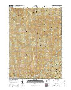
~ Soldier Camp Mountain OR topo map, 1:24000 scale, 7.5 X 7.5 Minute, Current, 2014
Soldier Camp Mountain, Oregon, USGS topographic map dated 2014.
Includes geographic coordinates (latitude and longitude). This topographic map is suitable for hiking, camping, and exploring, or framing it as a wall map.
Printed on-demand using high resolution imagery, on heavy weight and acid free paper, or alternatively on a variety of synthetic materials.
Topos available on paper, Waterproof, Poly, or Tyvek. Usually shipping rolled, unless combined with other folded maps in one order.
- Product Number: USGS-7254576
- Free digital map download (high-resolution, GeoPDF): Soldier Camp Mountain, Oregon (file size: 38 MB)
- Map Size: please refer to the dimensions of the GeoPDF map above
- Weight (paper map): ca. 55 grams
- Map Type: POD USGS Topographic Map
- Map Series: US Topo
- Map Verison: Current
- Cell ID: 42000
- Datum: North American Datum of 1983
- Map Projection: Transverse Mercator
- Map Cell Name: Soldier Camp Mountain
- Grid size: 7.5 X 7.5 Minute
- Date on map: 2014
- Map Scale: 1:24000
- Geographical region: Oregon, United States
Neighboring Maps:
All neighboring USGS topo maps are available for sale online at a variety of scales.
Spatial coverage:
Topo map Soldier Camp Mountain, Oregon, covers the geographical area associated the following places:
- Combs Riffle - Lower River Trail - Nail Keg Creek - Silver Creek Riffle - Lake of the Woods Mountain - Adams Prairie - Second Prairie Mountain - Upper Coal Riffle - North Fork Lobster Creek - Shindler Riffle - Rachels Delight Riffle - JoAnn Creek - Nail Keg Riffle - South Fork Lobster Creek - Bear Canyon - Fall Mountain - Schoolhouse Creek - Little Canyon - Slide Creek - Wake Up Rilea Creek - Steffin Meadow - Bear Riffle - Tom East Creek - New Riffle - Tom East Riffle - Bacon Flat - Soldier Camp Mountain - Bridge Creek - Silver Creek - Sherman Riffle - Potato Illahe Mountain - Iron Creek - Sawtooth Rock - Dog Creek - Auberry Riffle - Skookumhouse Prairie - Slide Creek Riffle - Boulder Creek - Auberry Creek
- Map Area ID: AREA42.62542.5-124.25-124.125
- Northwest corner Lat/Long code: USGSNW42.625-124.25
- Northeast corner Lat/Long code: USGSNE42.625-124.125
- Southwest corner Lat/Long code: USGSSW42.5-124.25
- Southeast corner Lat/Long code: USGSSE42.5-124.125
- Northern map edge Latitude: 42.625
- Southern map edge Latitude: 42.5
- Western map edge Longitude: -124.25
- Eastern map edge Longitude: -124.125


