
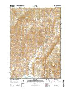
~ Rowe Creek OR topo map, 1:24000 scale, 7.5 X 7.5 Minute, Current, 2014
Rowe Creek, Oregon, USGS topographic map dated 2014.
Includes geographic coordinates (latitude and longitude). This topographic map is suitable for hiking, camping, and exploring, or framing it as a wall map.
Printed on-demand using high resolution imagery, on heavy weight and acid free paper, or alternatively on a variety of synthetic materials.
Topos available on paper, Waterproof, Poly, or Tyvek. Usually shipping rolled, unless combined with other folded maps in one order.
- Product Number: USGS-7254296
- Free digital map download (high-resolution, GeoPDF): Rowe Creek, Oregon (file size: 37 MB)
- Map Size: please refer to the dimensions of the GeoPDF map above
- Weight (paper map): ca. 55 grams
- Map Type: POD USGS Topographic Map
- Map Series: US Topo
- Map Verison: Current
- Cell ID: 71455
- Datum: North American Datum of 1983
- Map Projection: Transverse Mercator
- Map Cell Name: Rowe Creek
- Grid size: 7.5 X 7.5 Minute
- Date on map: 2014
- Map Scale: 1:24000
- Geographical region: Oregon, United States
Neighboring Maps:
All neighboring USGS topo maps are available for sale online at a variety of scales.
Spatial coverage:
Topo map Rowe Creek, Oregon, covers the geographical area associated the following places:
- Sutton Ranch - Tap Horn Gap - Red Rock - Bull Canyon - Jumbo Ridge - Beard Canyon - Thompson Canyon - Mortimore Canyon - Squaw Butte - Rock Mountain - Jumbo Springs - Griffin Canyon - Beckley Spring - Rowe Creek - Rowe Creek Dam - Shell Rock Spring - Rim Rock Springs - Kotzman Butte - Dedman Canyon - Crosswhite Canyon - The Flat - Left Hand Canyon - Sugarloaf Mountain - Lambing Camp Canyon - Craggy Rock - Walker Canyon - Table Mountain - Crosswhite Butte - Rock Canyon - Thompson Butte - Kentucky Canyon - Mathieson Spring - Homestead Spring - Rowe Creek Reservoir - Sugarloaf Canyon - Alkali Springs - Jennies Peak Canyon - Kentucky Butte - Kentucky Ridge - Dry Hollow - Liberty Bottom
- Map Area ID: AREA44.87544.75-120.25-120.125
- Northwest corner Lat/Long code: USGSNW44.875-120.25
- Northeast corner Lat/Long code: USGSNE44.875-120.125
- Southwest corner Lat/Long code: USGSSW44.75-120.25
- Southeast corner Lat/Long code: USGSSE44.75-120.125
- Northern map edge Latitude: 44.875
- Southern map edge Latitude: 44.75
- Western map edge Longitude: -120.25
- Eastern map edge Longitude: -120.125


