
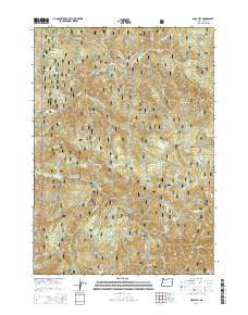
~ Rose Hill OR topo map, 1:24000 scale, 7.5 X 7.5 Minute, Current, 2014
Rose Hill, Oregon, USGS topographic map dated 2014.
Includes geographic coordinates (latitude and longitude). This topographic map is suitable for hiking, camping, and exploring, or framing it as a wall map.
Printed on-demand using high resolution imagery, on heavy weight and acid free paper, or alternatively on a variety of synthetic materials.
Topos available on paper, Waterproof, Poly, or Tyvek. Usually shipping rolled, unless combined with other folded maps in one order.
- Product Number: USGS-7254294
- Free digital map download (high-resolution, GeoPDF): Rose Hill, Oregon (file size: 38 MB)
- Map Size: please refer to the dimensions of the GeoPDF map above
- Weight (paper map): ca. 55 grams
- Map Type: POD USGS Topographic Map
- Map Series: US Topo
- Map Verison: Current
- Cell ID: 71444
- Datum: North American Datum of 1983
- Map Projection: Transverse Mercator
- Map Cell Name: Rose Hill
- Grid size: 7.5 X 7.5 Minute
- Date on map: 2014
- Map Scale: 1:24000
- Geographical region: Oregon, United States
Neighboring Maps:
All neighboring USGS topo maps are available for sale online at a variety of scales.
Spatial coverage:
Topo map Rose Hill, Oregon, covers the geographical area associated the following places:
- Green Rock Mine - Sugarloaf Mountain - Upper Trestle Creek Falls - Crawfish Creek - Lower Trestle Creek Falls - Hotel Spring - Hobo Creek Recreation Site - Hobo Creek - Layng Creek Ranger Station - Herman Creek - Inch Creek - Cedar Creek - Dog Creek - Lund Park Recreation Site - Kelly Ridge - Doris Creek - Harvey Creek - Cedar Creek Recreation Site - Rose Hill - Spirit Falls - West Fork Prather Creek - Blodgett Creek - East Fork Layng Creek - Champion Creek - Crawfish Lake - Junetta Creek - Adams Creek - Rujada Point - Donna Creek - Rujada Recreation Site - Trestle Creek - Doris Ridge - Curran Creek - Marten Creek - Layng Creek Fossil Beds - Harvey Point - East Fork Prather Creek - Silverstairs Creek - Patterson Creek - Alex Creek - Dinner Creek - Cedar Spring - Rujada Post Office (historical) - Bonita Post Office (historical) - Cat Creek - Laying Creek Water Treatment Plant - Prather Creek - Saltpeter Creek
- Map Area ID: AREA43.7543.625-122.75-122.625
- Northwest corner Lat/Long code: USGSNW43.75-122.75
- Northeast corner Lat/Long code: USGSNE43.75-122.625
- Southwest corner Lat/Long code: USGSSW43.625-122.75
- Southeast corner Lat/Long code: USGSSE43.625-122.625
- Northern map edge Latitude: 43.75
- Southern map edge Latitude: 43.625
- Western map edge Longitude: -122.75
- Eastern map edge Longitude: -122.625


