
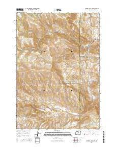
~ Picture Gorge West OR topo map, 1:24000 scale, 7.5 X 7.5 Minute, Current, 2014
Picture Gorge West, Oregon, USGS topographic map dated 2014.
Includes geographic coordinates (latitude and longitude). This topographic map is suitable for hiking, camping, and exploring, or framing it as a wall map.
Printed on-demand using high resolution imagery, on heavy weight and acid free paper, or alternatively on a variety of synthetic materials.
Topos available on paper, Waterproof, Poly, or Tyvek. Usually shipping rolled, unless combined with other folded maps in one order.
- Product Number: USGS-7254010
- Free digital map download (high-resolution, GeoPDF): Picture Gorge West, Oregon (file size: 34 MB)
- Map Size: please refer to the dimensions of the GeoPDF map above
- Weight (paper map): ca. 55 grams
- Map Type: POD USGS Topographic Map
- Map Series: US Topo
- Map Verison: Current
- Cell ID: 35044
- Datum: North American Datum of 1983
- Map Projection: Transverse Mercator
- Map Cell Name: Picture Gorge West
- Grid size: 7.5 X 7.5 Minute
- Date on map: 2014
- Map Scale: 1:24000
- Geographical region: Oregon, United States
Neighboring Maps:
All neighboring USGS topo maps are available for sale online at a variety of scales.
Spatial coverage:
Topo map Picture Gorge West, Oregon, covers the geographical area associated the following places:
- Humphrey Ranch - Jerrys Draw - Lone Pine Trail - Buckhorn Creek - Rock Creek - Birch Creek - Little Rattlesnake Creek - Artman Basin - Mule Gulch - Old Armunger Cabin - Butler Basin - Goose Rock Bridge - Dick Creek - Frank Creek - Thomas Condon Paleontology Center - Cal Smith Spring - John Day Fossil Beds National Monument Cant Ranch Museum - Johnny Kirk Spring - Sheep Rock - Goose Rock - Juniper Gulch - Jerrys Ridge - John Day Fossil Beds National Monument - Waterspout Gulch - Goose Creek - Mountain Creek - Old Johnson Cabin - Hog Ridge - Old Buckhorn Ranch - Deep Creek - Johnny Creek - Picture Gorge - Deer Gulch - Tri-Creek Ranch - Indian Creek - National Park Service John Day Fossil Beds National Monument Ranger Station
- Map Area ID: AREA44.62544.5-119.75-119.625
- Northwest corner Lat/Long code: USGSNW44.625-119.75
- Northeast corner Lat/Long code: USGSNE44.625-119.625
- Southwest corner Lat/Long code: USGSSW44.5-119.75
- Southeast corner Lat/Long code: USGSSE44.5-119.625
- Northern map edge Latitude: 44.625
- Southern map edge Latitude: 44.5
- Western map edge Longitude: -119.75
- Eastern map edge Longitude: -119.625


