
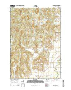
~ Muddy Valley OR topo map, 1:24000 scale, 7.5 X 7.5 Minute, Current, 2014
Muddy Valley, Oregon, USGS topographic map dated 2014.
Includes geographic coordinates (latitude and longitude). This topographic map is suitable for hiking, camping, and exploring, or framing it as a wall map.
Printed on-demand using high resolution imagery, on heavy weight and acid free paper, or alternatively on a variety of synthetic materials.
Topos available on paper, Waterproof, Poly, or Tyvek. Usually shipping rolled, unless combined with other folded maps in one order.
- Product Number: USGS-7253504
- Free digital map download (high-resolution, GeoPDF): Muddy Valley, Oregon (file size: 32 MB)
- Map Size: please refer to the dimensions of the GeoPDF map above
- Weight (paper map): ca. 55 grams
- Map Type: POD USGS Topographic Map
- Map Series: US Topo
- Map Verison: Current
- Cell ID: 31033
- Datum: North American Datum of 1983
- Map Projection: Transverse Mercator
- Map Cell Name: Muddy Valley
- Grid size: 7.5 X 7.5 Minute
- Date on map: 2014
- Map Scale: 1:24000
- Geographical region: Oregon, United States
Neighboring Maps:
All neighboring USGS topo maps are available for sale online at a variety of scales.
Spatial coverage:
Topo map Muddy Valley, Oregon, covers the geographical area associated the following places:
- Snake Creek - Edward Grenfell County Park - Masonville Community Hall - Happy Valley Community Hall - The Butte - Muddy Creek - Monroe Landing County Park - Juliette County Park - Erratic Rock State Park - Orchard View - Devils Creek - Charles Metsker County Park - Middle Fork Muddy Creek - Vierra Springs - Blue Heron Reservoir - Dupee Valley - Gill Creek - Power House County Park - Haven Hill Pond - Sander Reservoir - Mach-O Acres Airport - Yamhill County - Happy Valley Cemetery - Eagle Point - Deer Creek - Muddy Valley - Happy Valley - Little Deer Creek - Peter Dinsdale Dam - South Yamhill Cemetery - Chase Post Office (historical) - Slide Mountain - East Fork Muddy Creek - Huber County Park - Mochettaz Reservoir
- Map Area ID: AREA45.2545.125-123.375-123.25
- Northwest corner Lat/Long code: USGSNW45.25-123.375
- Northeast corner Lat/Long code: USGSNE45.25-123.25
- Southwest corner Lat/Long code: USGSSW45.125-123.375
- Southeast corner Lat/Long code: USGSSE45.125-123.25
- Northern map edge Latitude: 45.25
- Southern map edge Latitude: 45.125
- Western map edge Longitude: -123.375
- Eastern map edge Longitude: -123.25


