
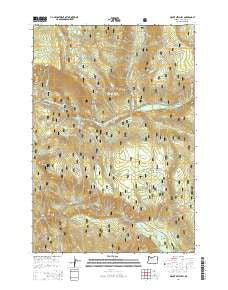
~ Mount Mitchell OR topo map, 1:24000 scale, 7.5 X 7.5 Minute, Current, 2014
Mount Mitchell, Oregon, USGS topographic map dated 2014.
Includes geographic coordinates (latitude and longitude). This topographic map is suitable for hiking, camping, and exploring, or framing it as a wall map.
Printed on-demand using high resolution imagery, on heavy weight and acid free paper, or alternatively on a variety of synthetic materials.
Topos available on paper, Waterproof, Poly, or Tyvek. Usually shipping rolled, unless combined with other folded maps in one order.
- Product Number: USGS-7253476
- Free digital map download (high-resolution, GeoPDF): Mount Mitchell, Oregon (file size: 37 MB)
- Map Size: please refer to the dimensions of the GeoPDF map above
- Weight (paper map): ca. 55 grams
- Map Type: POD USGS Topographic Map
- Map Series: US Topo
- Map Verison: Current
- Cell ID: 30715
- Datum: North American Datum of 1983
- Map Projection: Transverse Mercator
- Map Cell Name: Mount Mitchell
- Grid size: 7.5 X 7.5 Minute
- Date on map: 2014
- Map Scale: 1:24000
- Geographical region: Oregon, United States
Neighboring Maps:
All neighboring USGS topo maps are available for sale online at a variety of scales.
Spatial coverage:
Topo map Mount Mitchell, Oregon, covers the geographical area associated the following places:
- Devils Ridge Quarry - Lake Harriet - Buck Lake Trail - Oak Grove Butte - Peavine Creek - Shellrock Creek Recreation Site - Thunder Quarry - Sam Creek - Cabin Creek - Steep Spring - Lost Creek - KII Quarry - Pot Creek Trail - Hideaway Lake - Kink Creek - Hideaway Lake Recreation Site - Big Bottom - Lake Harriet Dam - Devils Spring Creek - Pot Creek Cabin - Cot Creek - Pot Creek - Mount Mitchell - Lake Harriet Recreation Site - Cottonwood Meadows Trail - Harriet Lake Boat Launch - Granite Creek - Pan Creek - Wolf Creek - Gee Zee Quarry - Devils Spring - Spring Creek - Cottonwood Meadows - Canyon Creek - Skunk Creek - Lightning Creek - Shellrock Creek - Kelley Creek
- Map Area ID: AREA45.12545-122-121.875
- Northwest corner Lat/Long code: USGSNW45.125-122
- Northeast corner Lat/Long code: USGSNE45.125-121.875
- Southwest corner Lat/Long code: USGSSW45-122
- Southeast corner Lat/Long code: USGSSE45-121.875
- Northern map edge Latitude: 45.125
- Southern map edge Latitude: 45
- Western map edge Longitude: -122
- Eastern map edge Longitude: -121.875


