
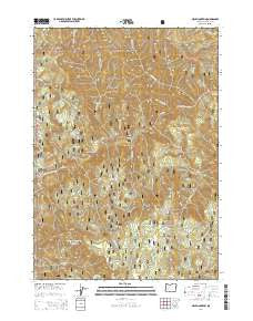
~ Mace Mountain OR topo map, 1:24000 scale, 7.5 X 7.5 Minute, Current, 2014
Mace Mountain, Oregon, USGS topographic map dated 2014.
Includes geographic coordinates (latitude and longitude). This topographic map is suitable for hiking, camping, and exploring, or framing it as a wall map.
Printed on-demand using high resolution imagery, on heavy weight and acid free paper, or alternatively on a variety of synthetic materials.
Topos available on paper, Waterproof, Poly, or Tyvek. Usually shipping rolled, unless combined with other folded maps in one order.
- Product Number: USGS-7252954
- Free digital map download (high-resolution, GeoPDF): Mace Mountain, Oregon (file size: 39 MB)
- Map Size: please refer to the dimensions of the GeoPDF map above
- Weight (paper map): ca. 55 grams
- Map Type: POD USGS Topographic Map
- Map Series: US Topo
- Map Verison: Current
- Cell ID: 27104
- Datum: North American Datum of 1983
- Map Projection: Transverse Mercator
- Map Cell Name: Mace Mountain
- Grid size: 7.5 X 7.5 Minute
- Date on map: 2014
- Map Scale: 1:24000
- Geographical region: Oregon, United States
Neighboring Maps:
All neighboring USGS topo maps are available for sale online at a variety of scales.
Spatial coverage:
Topo map Mace Mountain, Oregon, covers the geographical area associated the following places:
- Willow Flats Recreation Site - Bogus Creek Recreation Site - Fisher Creek - Fall Creek Recreation Site - Burnt Creek - Wright Creek - Grotto Falls - Jobs Garden - Fox Creek - Fairview Creek - Gobblers Knob - Emile Falls - Archie Creek - Williams Creek Recreation Site - Cougar Bluffs - Timber Creek - Mace Mountain - Thunder Mountain Trail - John Creek - Williams Creek Trail - Swamp Creek - Bogus Creek - Fall Creek - Thunder Creek - Thunder Mountain - Alder Creek - Blitzen Butte - Willow Flats - Williams Creek - Raspberry Creek - Mott Trail - Cougar Creek
- Map Area ID: AREA43.37543.25-122.875-122.75
- Northwest corner Lat/Long code: USGSNW43.375-122.875
- Northeast corner Lat/Long code: USGSNE43.375-122.75
- Southwest corner Lat/Long code: USGSSW43.25-122.875
- Southeast corner Lat/Long code: USGSSE43.25-122.75
- Northern map edge Latitude: 43.375
- Southern map edge Latitude: 43.25
- Western map edge Longitude: -122.875
- Eastern map edge Longitude: -122.75


