
~ Abbott Butte OR topo map, 1:24000 scale, 7.5 X 7.5 Minute, Current, 2014
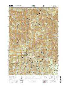
Abbott Butte, Oregon, USGS topographic map dated 2014.
Includes geographic coordinates (latitude and longitude). This topographic map is suitable for hiking, camping, and exploring, or framing it as a wall map.
Printed on-demand using high resolution imagery, on heavy weight and acid free paper, or alternatively on a variety of synthetic materials.
Topos available on paper, Waterproof, Poly, or Tyvek. Usually shipping rolled, unless combined with other folded maps in one order.
- Product Number: USGS-7252728
- Free digital map download (high-resolution, GeoPDF): Abbott Butte, Oregon (file size: 40 MB)
- Map Size: please refer to the dimensions of the GeoPDF map above
- Weight (paper map): ca. 55 grams
- Map Type: POD USGS Topographic Map
- Map Series: US Topo
- Map Verison: Current
- Cell ID: 72256
- Datum: North American Datum of 1983
- Map Projection: Transverse Mercator
- Map Cell Name: Abbott Butte
- Grid size: 7.5 X 7.5 Minute
- Date on map: 2014
- Map Scale: 1:24000
- Geographical region: Oregon, United States
Neighboring Maps:
All neighboring USGS topo maps are available for sale online at a variety of scales.
Spatial coverage:
Topo map Abbott Butte, Oregon, covers the geographical area associated the following places:
- Cougar Creek - Five Sticks Camp - Quartz Mountain - Grey Rock - Sandstone Trail - Neal Springs Campground - Huckleberry Lake - Sunshine Creek - Donegan Prairies - Little Sunshine Creek - Abbott Creek Research Natural Area - Paradise Creek - Little Bear Camp - Saddle Camp - Tripod Camp - Woodruff Meadow - Umpqua Rogue Trail - DeWitt Creek - Golden Stairs Trail - Red Fir Creek - Neal Spring - Buck Basin Burn - Abbott Creek - West Fork Abbott Creek - Whaleback - Abbott Creek Recreation Site - Big Bear Camp - Huckleberry Gap - Paradise Camp - Elephant Head - Freddy Camp - Cougar Butte - Abbott Butte Lookout - Abbott Butte - Woodruff Creek - Windy Gap - Falcon Creek - Huckleberry Lake Campground - North Fork Abbott Creek - Cow Camp - McCall Creek - Falcon Butte
- Map Area ID: AREA4342.875-122.625-122.5
- Northwest corner Lat/Long code: USGSNW43-122.625
- Northeast corner Lat/Long code: USGSNE43-122.5
- Southwest corner Lat/Long code: USGSSW42.875-122.625
- Southeast corner Lat/Long code: USGSSE42.875-122.5
- Northern map edge Latitude: 43
- Southern map edge Latitude: 42.875
- Western map edge Longitude: -122.625
- Eastern map edge Longitude: -122.5


