
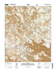
~ White Horse Lake AZ topo map, 1:24000 scale, 7.5 X 7.5 Minute, 2014
White Horse Lake, Arizona, USGS topographic map dated 2014.
Includes geographic coordinates (latitude and longitude). This topographic map is suitable for hiking, camping, and exploring, or framing it as a wall map.
Printed on-demand using high resolution imagery, on heavy weight and acid free paper, or alternatively on a variety of synthetic materials.
Topos available on paper, Waterproof, Poly, or Tyvek. Usually shipping rolled, unless combined with other folded maps in one order.
- Product Number: USGS-7245023
- Free digital map download (high-resolution, GeoPDF): White Horse Lake, Arizona (file size: 31 MB)
- Map Size: please refer to the dimensions of the GeoPDF map above
- Weight (paper map): ca. 55 grams
- Map Type: POD USGS Topographic Map
- Map Series: US Topo
- Map Verison: Current
- Cell ID: 48689
- Datum: North American Datum of 1983
- Map Projection: Transverse Mercator
- Map Cell Name: White Horse Lake
- Grid size: 7.5 X 7.5 Minute
- Date on map: 2014
- Map Scale: 1:24000
- Geographical region: Arizona, United States
Neighboring Maps:
All neighboring USGS topo maps are available for sale online at a variety of scales.
Spatial coverage:
Topo map White Horse Lake, Arizona, covers the geographical area associated the following places:
- Ike Tank - Rain Trick Tank - Hill Two - Rock Tank - Hitt Spring - Lake Pocket - Wildlife Tank Number Two - Sawlog Tank - Wagner Tank - Ruin Tank - Tule Tank Wash - Lee Tank - Round Mountain Tank - White Horse Lake - Lee Canyon - White Horse Knoll - Favour Tank - White Horse Lake Family Campground - Middle Tank - Pulp Tank - Red Tank - Wagner Hill - Burn Tank - Juniper Tank - Indian Hill - Hog Tank - JD Dam Wash - Holloway Spring - Whitetail Tank - White Horse Recreation Site - Cobble Flat - Perkins Knoll - Saginaw Tank - Deadman Pocket - Holloway Tank - Ruin Mountain - Boulder Tank - Hill Three - Scar Tank - Elk Tank - PG Tank - Red Knoll - JD Dam Lake - Flag Tank - Tule Tank - Hill One - Limestone Pocket - Pocket Lake - Round Mountain - Perkins Tank - Lonesome Pocket - Distribution Tank - Bar Cross Tank - White Horse Ranger Station
- Map Area ID: AREA35.12535-112.125-112
- Northwest corner Lat/Long code: USGSNW35.125-112.125
- Northeast corner Lat/Long code: USGSNE35.125-112
- Southwest corner Lat/Long code: USGSSW35-112.125
- Southeast corner Lat/Long code: USGSSE35-112
- Northern map edge Latitude: 35.125
- Southern map edge Latitude: 35
- Western map edge Longitude: -112.125
- Eastern map edge Longitude: -112


