
~ White Horse Hills AZ topo map, 1:24000 scale, 7.5 X 7.5 Minute, 2014
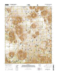
White Horse Hills, Arizona, USGS topographic map dated 2014.
Includes geographic coordinates (latitude and longitude). This topographic map is suitable for hiking, camping, and exploring, or framing it as a wall map.
Printed on-demand using high resolution imagery, on heavy weight and acid free paper, or alternatively on a variety of synthetic materials.
Topos available on paper, Waterproof, Poly, or Tyvek. Usually shipping rolled, unless combined with other folded maps in one order.
- Product Number: USGS-7245021
- Free digital map download (high-resolution, GeoPDF): White Horse Hills, Arizona (file size: 27 MB)
- Map Size: please refer to the dimensions of the GeoPDF map above
- Weight (paper map): ca. 55 grams
- Map Type: POD USGS Topographic Map
- Map Series: US Topo
- Map Verison: Current
- Cell ID: 48688
- Datum: North American Datum of 1983
- Map Projection: Transverse Mercator
- Map Cell Name: White Horse Hills
- Grid size: 7.5 X 7.5 Minute
- Date on map: 2014
- Map Scale: 1:24000
- Geographical region: Arizona, United States
Neighboring Maps:
All neighboring USGS topo maps are available for sale online at a variety of scales.
Spatial coverage:
Topo map White Horse Hills, Arizona, covers the geographical area associated the following places:
- White Horse Canyon - Pat Tank - Indian Tank - Deep Tank - Saddle Trick Tank - Indian Flat - Badger Tank - Black Tank - Lookout Tank - Aubineau Canyon - Pat Spring - Saddle Mountain - Borrego Trick Tank - Pete Number One Tank - Reese Tanks - Goat Tank - Potato Tank - Elizabeth Tank - Hall Tank - Walker Lake - Howard Seep Tank - Pat Tank - McKinney Tank - Geyler Tank - Tub Number One - Tub Number Two - Lavin Tank - Road Tank - Reese Canyon - Yellow Jacket Tank - Kendrick Park Forest Service Station - Howard Seep - Kendrick Tank - Tub Number Three - Kelly Tank - Bonita Tank - White Horse Hills - Maverick Butte
- Map Area ID: AREA35.535.375-111.75-111.625
- Northwest corner Lat/Long code: USGSNW35.5-111.75
- Northeast corner Lat/Long code: USGSNE35.5-111.625
- Southwest corner Lat/Long code: USGSSW35.375-111.75
- Southeast corner Lat/Long code: USGSSE35.375-111.625
- Northern map edge Latitude: 35.5
- Southern map edge Latitude: 35.375
- Western map edge Longitude: -111.75
- Eastern map edge Longitude: -111.625


