
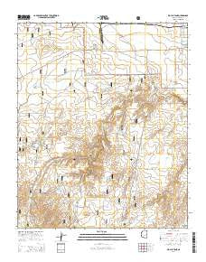
~ Big Pug Tank AZ topo map, 1:24000 scale, 7.5 X 7.5 Minute, 2014
Big Pug Tank, Arizona, USGS topographic map dated 2014.
Includes geographic coordinates (latitude and longitude). This topographic map is suitable for hiking, camping, and exploring, or framing it as a wall map.
Printed on-demand using high resolution imagery, on heavy weight and acid free paper, or alternatively on a variety of synthetic materials.
Topos available on paper, Waterproof, Poly, or Tyvek. Usually shipping rolled, unless combined with other folded maps in one order.
- Product Number: USGS-7242195
- Free digital map download (high-resolution, GeoPDF): Big Pug Tank, Arizona (file size: 25 MB)
- Map Size: please refer to the dimensions of the GeoPDF map above
- Weight (paper map): ca. 55 grams
- Map Type: POD USGS Topographic Map
- Map Series: US Topo
- Map Verison: Current
- Cell ID: 72278
- Datum: North American Datum of 1983
- Map Projection: Transverse Mercator
- Map Cell Name: Big Pug Tank
- Grid size: 7.5 X 7.5 Minute
- Date on map: 2014
- Map Scale: 1:24000
- Geographical region: Arizona, United States
Neighboring Maps:
All neighboring USGS topo maps are available for sale online at a variety of scales.
Spatial coverage:
Topo map Big Pug Tank, Arizona, covers the geographical area associated the following places:
- Thomas Tank - Exchange Tank - Holy Oak Tank - Walker Lake - Big Pug Tank - Little Pug Tank - Walker Well - Government Tank - Long Hollow Tank - Cottonwood Number Two Tank - Town Well - Max Tank - Pitt Tank - Woodland Tank - Dry Tank - Day Wash - Section Twentyseven Tank - Pine Tank - Gressey Tank - XIL Tank - Swale Tank - Flood Tank - Northwest Tank - Hidden Tank - Number Four Trick Tank - Kays Tank - Middle Tank - New Tank - Lakeside Ranger District - Upper Tank - Cottonwood Number One Tank - Snowflake Landing - Dalton Tank - Winter Tank - Ellsworth Tank - Lee Summers Tank - Clay Springs Tank - Jackrabbit Tank
- Map Area ID: AREA34.534.375-110.375-110.25
- Northwest corner Lat/Long code: USGSNW34.5-110.375
- Northeast corner Lat/Long code: USGSNE34.5-110.25
- Southwest corner Lat/Long code: USGSSW34.375-110.375
- Southeast corner Lat/Long code: USGSSE34.375-110.25
- Northern map edge Latitude: 34.5
- Southern map edge Latitude: 34.375
- Western map edge Longitude: -110.375
- Eastern map edge Longitude: -110.25


