
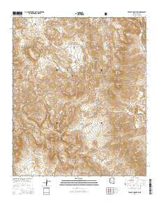
~ Teapot Mountain AZ topo map, 1:24000 scale, 7.5 X 7.5 Minute, 2014
Teapot Mountain, Arizona, USGS topographic map dated 2014.
Includes geographic coordinates (latitude and longitude). This topographic map is suitable for hiking, camping, and exploring, or framing it as a wall map.
Printed on-demand using high resolution imagery, on heavy weight and acid free paper, or alternatively on a variety of synthetic materials.
Topos available on paper, Waterproof, Poly, or Tyvek. Usually shipping rolled, unless combined with other folded maps in one order.
- Product Number: USGS-7241981
- Free digital map download (high-resolution, GeoPDF): Teapot Mountain, Arizona (file size: 29 MB)
- Map Size: please refer to the dimensions of the GeoPDF map above
- Weight (paper map): ca. 55 grams
- Map Type: POD USGS Topographic Map
- Map Series: US Topo
- Map Verison: Current
- Cell ID: 44429
- Datum: North American Datum of 1983
- Map Projection: Transverse Mercator
- Map Cell Name: Teapot Mountain
- Grid size: 7.5 X 7.5 Minute
- Date on map: 2014
- Map Scale: 1:24000
- Geographical region: Arizona, United States
Neighboring Maps:
All neighboring USGS topo maps are available for sale online at a variety of scales.
Spatial coverage:
Topo map Teapot Mountain, Arizona, covers the geographical area associated the following places:
- Lower EK tank - Red Tank - Copper Butte - Copper Butte Mine - Ray Mine Open Pit - White Canyon - Rawhide Canyon - Sleeping Beauty Mountain - Granite Mountain - Walnut Spring - Black Hills Tank - Sup Hor Spring - Lime Tank - Teapot Mountain - Sonora Hill - Kanes Spring - Crucifixon Tank - Grapevine Spring - White Water Spring - Copper Canyon - White Canyon Wilderness - Red Hills - Arnett Well - The Spine - Wood Canyon Spring - Last Turn Hill - The Rincon - Sandow Hill - Lakel Flat - Wood Canyon - West Pit
- Map Area ID: AREA33.2533.125-111.125-111
- Northwest corner Lat/Long code: USGSNW33.25-111.125
- Northeast corner Lat/Long code: USGSNE33.25-111
- Southwest corner Lat/Long code: USGSSW33.125-111.125
- Southeast corner Lat/Long code: USGSSE33.125-111
- Northern map edge Latitude: 33.25
- Southern map edge Latitude: 33.125
- Western map edge Longitude: -111.125
- Eastern map edge Longitude: -111


