
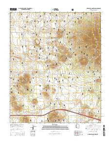
~ Sitgreaves Mountain AZ topo map, 1:24000 scale, 7.5 X 7.5 Minute, 2014
Sitgreaves Mountain, Arizona, USGS topographic map dated 2014.
Includes geographic coordinates (latitude and longitude). This topographic map is suitable for hiking, camping, and exploring, or framing it as a wall map.
Printed on-demand using high resolution imagery, on heavy weight and acid free paper, or alternatively on a variety of synthetic materials.
Topos available on paper, Waterproof, Poly, or Tyvek. Usually shipping rolled, unless combined with other folded maps in one order.
- Product Number: USGS-7241755
- Free digital map download (high-resolution, GeoPDF): Sitgreaves Mountain, Arizona (file size: 28 MB)
- Map Size: please refer to the dimensions of the GeoPDF map above
- Weight (paper map): ca. 55 grams
- Map Type: POD USGS Topographic Map
- Map Series: US Topo
- Map Verison: Current
- Cell ID: 41523
- Datum: North American Datum of 1983
- Map Projection: Transverse Mercator
- Map Cell Name: Sitgreaves Mountain
- Grid size: 7.5 X 7.5 Minute
- Date on map: 2014
- Map Scale: 1:24000
- Geographical region: Arizona, United States
Neighboring Maps:
All neighboring USGS topo maps are available for sale online at a variety of scales.
Spatial coverage:
Topo map Sitgreaves Mountain, Arizona, covers the geographical area associated the following places:
- White House Tank - Hope Tank - Schoolhouse Tank - Wade Spring - Dude Mountain Tank - Pardnership Tank - Bird Tank - Pouquette Hill - James Tank - Dag Tank - Freds Tank - Radio Hill - Johns Park - Pittman Interchange - Clark Tank - Locust Tank - Oak Hill Snow Play Area - Rupe Tank - Boxcar Hill - Burton Tank - T O Tank - Pipeline Tank West - Hardy Hill - Sitgreaves Mountain - Crowe Tank - Duck Lake - Oak Hill - Bald Mountain - Log Tank - Tanque Piedra - Beacon Hill - Pipeline Tank East - Rock Tank West - Keyhole Sink - Dry Lake - Moss Tank - Willow Spring Tank - Pouquette Tank - Station Tank - Hitson Tank - South Tank - Garland Interchange - Perry Tank - McHat Tank - Buggy Wheel Tank - Frenchy Spring Tank - Pedigo Tank - Chalender Underpass - Davenport Lake - Dude Mountain - Frenchy Hill - Indian Seeps Tank - Twin Tanks - Rock Tank - Jonns Park - Williams - Circle Pines Kampgrounds of America - Pitman Valley Helibase
- Map Area ID: AREA35.37535.25-112.125-112
- Northwest corner Lat/Long code: USGSNW35.375-112.125
- Northeast corner Lat/Long code: USGSNE35.375-112
- Southwest corner Lat/Long code: USGSSW35.25-112.125
- Southeast corner Lat/Long code: USGSSE35.25-112
- Northern map edge Latitude: 35.375
- Southern map edge Latitude: 35.25
- Western map edge Longitude: -112.125
- Eastern map edge Longitude: -112


