
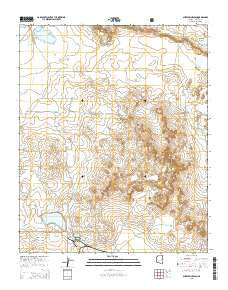
~ Sheepskin Wash AZ topo map, 1:24000 scale, 7.5 X 7.5 Minute, 2014
Sheepskin Wash, Arizona, USGS topographic map dated 2014.
Includes geographic coordinates (latitude and longitude). This topographic map is suitable for hiking, camping, and exploring, or framing it as a wall map.
Printed on-demand using high resolution imagery, on heavy weight and acid free paper, or alternatively on a variety of synthetic materials.
Topos available on paper, Waterproof, Poly, or Tyvek. Usually shipping rolled, unless combined with other folded maps in one order.
- Product Number: USGS-7241671
- Free digital map download (high-resolution, GeoPDF): Sheepskin Wash, Arizona (file size: 21 MB)
- Map Size: please refer to the dimensions of the GeoPDF map above
- Weight (paper map): ca. 55 grams
- Map Type: POD USGS Topographic Map
- Map Series: US Topo
- Map Verison: Current
- Cell ID: 40915
- Datum: North American Datum of 1983
- Map Projection: Transverse Mercator
- Map Cell Name: Sheepskin Wash
- Grid size: 7.5 X 7.5 Minute
- Date on map: 2014
- Map Scale: 1:24000
- Geographical region: Arizona, United States
Neighboring Maps:
All neighboring USGS topo maps are available for sale online at a variety of scales.
Spatial coverage:
Topo map Sheepskin Wash, Arizona, covers the geographical area associated the following places:
- Decker Tank - Rattlesnake Tank - Happy Tank - Phoenix Park Wash - Sheepskin Tank - Morris Tank - Bushman Draw - Twin Lakes - Indian Rock Tank - Sheepskin Wash - Prince Tank - Mikes Tank - Red Lake Tank - Indian Rock - Zeniff Substation - Coyote Tank - Rocking Chair Ranch - Three Way Tank - Settling Tank - Pearce Tank - Sacaton Tank - Morris Windmill
- Map Area ID: AREA34.62534.5-110.375-110.25
- Northwest corner Lat/Long code: USGSNW34.625-110.375
- Northeast corner Lat/Long code: USGSNE34.625-110.25
- Southwest corner Lat/Long code: USGSSW34.5-110.375
- Southeast corner Lat/Long code: USGSSE34.5-110.25
- Northern map edge Latitude: 34.625
- Southern map edge Latitude: 34.5
- Western map edge Longitude: -110.375
- Eastern map edge Longitude: -110.25


