
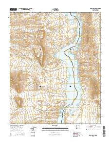
~ Mount Davis AZ topo map, 1:24000 scale, 7.5 X 7.5 Minute, 2014
Mount Davis, Arizona, USGS topographic map dated 2014.
Includes geographic coordinates (latitude and longitude). This topographic map is suitable for hiking, camping, and exploring, or framing it as a wall map.
Printed on-demand using high resolution imagery, on heavy weight and acid free paper, or alternatively on a variety of synthetic materials.
Topos available on paper, Waterproof, Poly, or Tyvek. Usually shipping rolled, unless combined with other folded maps in one order.
- Product Number: USGS-7241119
- Free digital map download (high-resolution, GeoPDF): Mount Davis, Arizona (file size: 24 MB)
- Map Size: please refer to the dimensions of the GeoPDF map above
- Weight (paper map): ca. 55 grams
- Map Type: POD USGS Topographic Map
- Map Series: US Topo
- Map Verison: Current
- Cell ID: 30555
- Datum: North American Datum of 1983
- Map Projection: Transverse Mercator
- Map Cell Name: Mount Davis
- Grid size: 7.5 X 7.5 Minute
- Date on map: 2014
- Map Scale: 1:24000
- Geographical region: Arizona, United States
Neighboring Maps:
All neighboring USGS topo maps are available for sale online at a variety of scales.
Spatial coverage:
Topo map Mount Davis, Arizona, covers the geographical area associated the following places:
- Twin Coves - Gold Cove - Round Island (historical) - Elephant Hill - Two Dollar Cove - Rockefeller Cove - Apache Tear Cove - Round Island (historical) - Tyee Cove - Golden Door Cove - Nevada Bay - Cottonwood Valley - Bonnie Brae Cove - Arizona Bay - Catclaw Cove - Solicitor Cove - Opal Mountain - Coyote Spring Cove - Sheeptrail Cove - Painted Canyon Cove - Owl Cove - Opal Cove - Copper Mountain Cove - Mount Davis - Basalt Cove - Owl Point - Yuma Cove - Owl Point Cove - Sand Hole - Wrong Cove - Jeff Davis Cove - Klondike Cove - Great West Cove - Antelope Cove - Castle Cove - Gold Spike Cove - Bass Cove
- Map Area ID: AREA35.62535.5-114.75-114.625
- Northwest corner Lat/Long code: USGSNW35.625-114.75
- Northeast corner Lat/Long code: USGSNE35.625-114.625
- Southwest corner Lat/Long code: USGSSW35.5-114.75
- Southeast corner Lat/Long code: USGSSE35.5-114.625
- Northern map edge Latitude: 35.625
- Southern map edge Latitude: 35.5
- Western map edge Longitude: -114.75
- Eastern map edge Longitude: -114.625


