
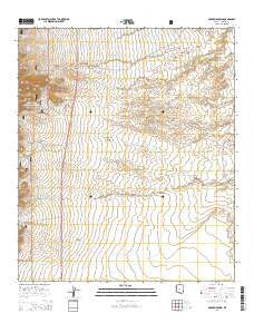
~ McGrew Spring AZ topo map, 1:24000 scale, 7.5 X 7.5 Minute, 2014
McGrew Spring, Arizona, USGS topographic map dated 2014.
Includes geographic coordinates (latitude and longitude). This topographic map is suitable for hiking, camping, and exploring, or framing it as a wall map.
Printed on-demand using high resolution imagery, on heavy weight and acid free paper, or alternatively on a variety of synthetic materials.
Topos available on paper, Waterproof, Poly, or Tyvek. Usually shipping rolled, unless combined with other folded maps in one order.
- Product Number: USGS-7240921
- Free digital map download (high-resolution, GeoPDF): McGrew Spring, Arizona (file size: 28 MB)
- Map Size: please refer to the dimensions of the GeoPDF map above
- Weight (paper map): ca. 55 grams
- Map Type: POD USGS Topographic Map
- Map Series: US Topo
- Map Verison: Current
- Cell ID: 28395
- Datum: North American Datum of 1983
- Map Projection: Transverse Mercator
- Map Cell Name: McGrew Spring
- Grid size: 7.5 X 7.5 Minute
- Date on map: 2014
- Map Scale: 1:24000
- Geographical region: Arizona, United States
Neighboring Maps:
All neighboring USGS topo maps are available for sale online at a variety of scales.
Spatial coverage:
Topo map McGrew Spring, Arizona, covers the geographical area associated the following places:
- Kartchner Caverns State Park - Corner Tanks - Dry Canyon Spring - Middle Canyon - McGrew Spring - Guindani Canyon - Box Artesia Well - Canary Well - H & D Mine - Ricketts Mine - White Tank - Guidani Loop Trail Head - Mesquite Tank - Highway Tank - H & D Mine - Sacaton Tank - French Joe Tank - South Stock Tank - Bates Tank - Jog Tank - French Joe Camp - Corner Tank - Lone Star Tank - Middle Canyon Wash - French Joe Canyon - Lone Star Mine - Black Well - Road Tank - Southeast Stock Tank - Dry Canyon - Lower Tank - Ramsey Tank - Castanera Spring - Ricketts Well - Ricketts Storage
- Map Area ID: AREA31.87531.75-110.375-110.25
- Northwest corner Lat/Long code: USGSNW31.875-110.375
- Northeast corner Lat/Long code: USGSNE31.875-110.25
- Southwest corner Lat/Long code: USGSSW31.75-110.375
- Southeast corner Lat/Long code: USGSSE31.75-110.25
- Northern map edge Latitude: 31.875
- Southern map edge Latitude: 31.75
- Western map edge Longitude: -110.375
- Eastern map edge Longitude: -110.25


