
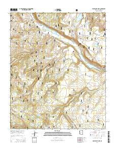
~ Lower Lake Mary AZ topo map, 1:24000 scale, 7.5 X 7.5 Minute, 2014
Lower Lake Mary, Arizona, USGS topographic map dated 2014.
Includes geographic coordinates (latitude and longitude). This topographic map is suitable for hiking, camping, and exploring, or framing it as a wall map.
Printed on-demand using high resolution imagery, on heavy weight and acid free paper, or alternatively on a variety of synthetic materials.
Topos available on paper, Waterproof, Poly, or Tyvek. Usually shipping rolled, unless combined with other folded maps in one order.
- Product Number: USGS-7240675
- Free digital map download (high-resolution, GeoPDF): Lower Lake Mary, Arizona (file size: 30 MB)
- Map Size: please refer to the dimensions of the GeoPDF map above
- Weight (paper map): ca. 55 grams
- Map Type: POD USGS Topographic Map
- Map Series: US Topo
- Map Verison: Current
- Cell ID: 26799
- Datum: North American Datum of 1983
- Map Projection: Transverse Mercator
- Map Cell Name: Lower Lake Mary
- Grid size: 7.5 X 7.5 Minute
- Date on map: 2014
- Map Scale: 1:24000
- Geographical region: Arizona, United States
Neighboring Maps:
All neighboring USGS topo maps are available for sale online at a variety of scales.
Spatial coverage:
Topo map Lower Lake Mary, Arizona, covers the geographical area associated the following places:
- Fisher and Fry Lake - Newman Tank - Joeys Tank - Johnneys Tank - Westec Tank - Clark Well - Lagunita Tank - Babbit Spring - Lower Lake Mary Dam - Sinkhole Tank - Rocky Tank - Natural Tank - Elk Park Meadows - Hoxworth Springs - Highlands Fire District Station 24 Lake Mary - Hoxworth Tank - Hold Up Tank - Lower Lake Mary Picnic Area - Little Dry Lake - Lake Mary Boating Site - Lake View Forest Camp - Hey Dog Tank - Upper Lake Mary Boat Launch Number 2 - Howard Tank - Canyon Vista Campground - Vail Lake - Upper Lake Mary Dam - Howard Draw - Statler Tank - Bonita Tank - Pit Number Two Tank - Forest Service Tank - Stump Tank - Lower Lake Mary - KZJC-TV (Flagstaff) - Priest Draw - Perkins Telescope - Little Dry Lake Tank - Lake Mary Meadows - Corner Tank - Double Tank - Coulter Park - Vail Lake Tank - United States Geological Survey Observatory - Lower Tank - Mount Lion Tank - Coulter Hill - Peterson Seepage - Pit One Tank - JAO Well - Lost Tank - Roadbed Tank - Mustang Park Tank - Lake Number One - Cañada Granda Tank - Marshall Lake - Narrows Boat Launch - Marshall Mesa Tank - Prime Lake - Coulter Cabin - Charco Tank - Nameless Tank - Wild Horse Tank - Thomas Spring
- Map Area ID: AREA35.12535-111.625-111.5
- Northwest corner Lat/Long code: USGSNW35.125-111.625
- Northeast corner Lat/Long code: USGSNE35.125-111.5
- Southwest corner Lat/Long code: USGSSW35-111.625
- Southeast corner Lat/Long code: USGSSE35-111.5
- Northern map edge Latitude: 35.125
- Southern map edge Latitude: 35
- Western map edge Longitude: -111.625
- Eastern map edge Longitude: -111.5


