
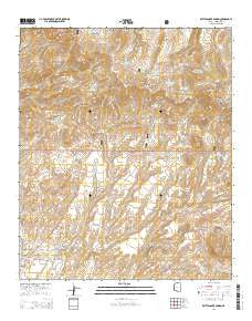
~ Rattlesnake Spring AZ topo map, 1:24000 scale, 7.5 X 7.5 Minute, 2014
Rattlesnake Spring, Arizona, USGS topographic map dated 2014.
Includes geographic coordinates (latitude and longitude). This topographic map is suitable for hiking, camping, and exploring, or framing it as a wall map.
Printed on-demand using high resolution imagery, on heavy weight and acid free paper, or alternatively on a variety of synthetic materials.
Topos available on paper, Waterproof, Poly, or Tyvek. Usually shipping rolled, unless combined with other folded maps in one order.
- Product Number: USGS-7240039
- Free digital map download (high-resolution, GeoPDF): Rattlesnake Spring, Arizona (file size: 27 MB)
- Map Size: please refer to the dimensions of the GeoPDF map above
- Weight (paper map): ca. 55 grams
- Map Type: POD USGS Topographic Map
- Map Series: US Topo
- Map Verison: Current
- Cell ID: 37132
- Datum: North American Datum of 1983
- Map Projection: Transverse Mercator
- Map Cell Name: Rattlesnake Spring
- Grid size: 7.5 X 7.5 Minute
- Date on map: 2014
- Map Scale: 1:24000
- Geographical region: Arizona, United States
Neighboring Maps:
All neighboring USGS topo maps are available for sale online at a variety of scales.
Spatial coverage:
Topo map Rattlesnake Spring, Arizona, covers the geographical area associated the following places:
- Rattlesnake Tanks Number Two - West Rustler Spring - Upper Rattlesnake Spring - Frank Davis Ranch - Silver Basin Tank - Lyda Creek - Cold Spring Mountain Tank - Gold Spring - Brushy Mountain Tank - High Mesa Tank - Rustlers Spring - Sixshooter Gap - Brushy Mountain - Black Jack Canyon - Fence Tank - Rattlesnake Pasture Tank - Rattlesnake Gap - Buzzard Roost Tank - White Peaks Tank - Rattlesnake Spring - Brushy Canyon Tank - Cold Water Spring - Cave Spring - Corner Tank - Silver Basin Corral - West Rustlers Spring - White Peaks - Lambing Camp Tank - Buzzard Roost Spring - Rattlesnake Tank - Soapbox Canyon - BUckhorn Tank - Gayle Tank - Red Hill - Cold Spring Mountain - Deer Basin Spring - Phillips Ranch - Hamilton Spring - Rattlesnake Gap Camp - Rattlesnake Gap Camp - Gap Holding Corral - West Brushy Canyon Tank - Chalk Peak - Hamilton Mesa - Rattlesnake Gap Tank - Sunset Peak - Woods Canyon Tank - Rustlers Canyon
- Map Area ID: AREA33.12533-109.25-109.125
- Northwest corner Lat/Long code: USGSNW33.125-109.25
- Northeast corner Lat/Long code: USGSNE33.125-109.125
- Southwest corner Lat/Long code: USGSSW33-109.25
- Southeast corner Lat/Long code: USGSSE33-109.125
- Northern map edge Latitude: 33.125
- Southern map edge Latitude: 33
- Western map edge Longitude: -109.25
- Eastern map edge Longitude: -109.125


