
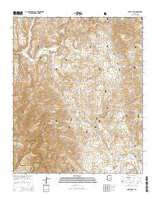
~ North Peak AZ topo map, 1:24000 scale, 7.5 X 7.5 Minute, 2014
North Peak, Arizona, USGS topographic map dated 2014.
Includes geographic coordinates (latitude and longitude). This topographic map is suitable for hiking, camping, and exploring, or framing it as a wall map.
Printed on-demand using high resolution imagery, on heavy weight and acid free paper, or alternatively on a variety of synthetic materials.
Topos available on paper, Waterproof, Poly, or Tyvek. Usually shipping rolled, unless combined with other folded maps in one order.
- Product Number: USGS-7239603
- Free digital map download (high-resolution, GeoPDF): North Peak, Arizona (file size: 30 MB)
- Map Size: please refer to the dimensions of the GeoPDF map above
- Weight (paper map): ca. 55 grams
- Map Type: POD USGS Topographic Map
- Map Series: US Topo
- Map Verison: Current
- Cell ID: 32441
- Datum: North American Datum of 1983
- Map Projection: Transverse Mercator
- Map Cell Name: North Peak
- Grid size: 7.5 X 7.5 Minute
- Date on map: 2014
- Map Scale: 1:24000
- Geographical region: Arizona, United States
Neighboring Maps:
All neighboring USGS topo maps are available for sale online at a variety of scales.
Spatial coverage:
Topo map North Peak, Arizona, covers the geographical area associated the following places:
- Maggie Mine - City Creek Trailhead - Little Green Mine - Brushy Hollow - Zulu Tank Number Two - Moore Mountain - Goldfish Tank - Pole Hollow Spring - Marysville Hill - Grapevine Spring - Gold Hill - Gold Hill Mine - Mineral Spring - Limestone Canyon - Pine Creek - Callahan Tank - Gould Springs - Browse Tank - Pig Spring - Cypress Thicket - Dennis Spring - Dennis Creek - Rock Creek - Surprise Spring - American Gulch - Snowstorm Mountain - Hanging Rock Spring - Rye Creek Tank - House Place Spring - Pole Hollow Canyon - Hill Creek - Wonder Gulch - Arrastre Tank - House Mine - Pasture Tank - Headquarters Well - Snowstorm Tank - Zulu Mine - Excursion Mine - Callahan Creek - Barnett Spring - North Peak - Delaware Wash - Doll Baby Trailhead - Hi Windmill - Table Mountain - Doll Baby Ranch - Table Mountain Canyon - City Creek Well - Arrastre Gulch - Hells Hole - Boyd Mountain - North Peak Trail - N B Ranch - City Creek - Thompson Draw - Little Maud Mine - Hill Tank - Mineral Creek - Larsen Spring - Flume Hollow - Gold Hill Tank - Zulu Wash - Grimes Spring - Hidden Spring - Lousy Gulch - Moore Wash - Simonton Flat - Boyd Mountain Spring - Saddle Tank - Collom Spring - Mineral Creek Trail - Waif Mine - Saint Johns Creek - House Creek - Mantkin Spring - Zulu Tank - Mineral Creek Trailhead - Callahan Mine - Summit Canyon - Sedge Spring - Booth Spring - Mazatzal Divide Trail - Collom Mine - The Park
- Map Area ID: AREA34.2534.125-111.5-111.375
- Northwest corner Lat/Long code: USGSNW34.25-111.5
- Northeast corner Lat/Long code: USGSNE34.25-111.375
- Southwest corner Lat/Long code: USGSSW34.125-111.5
- Southeast corner Lat/Long code: USGSSE34.125-111.375
- Northern map edge Latitude: 34.25
- Southern map edge Latitude: 34.125
- Western map edge Longitude: -111.5
- Eastern map edge Longitude: -111.375


