
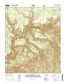
~ Hoodoo Knoll AZ topo map, 1:24000 scale, 7.5 X 7.5 Minute, 2014
Hoodoo Knoll, Arizona, USGS topographic map dated 2014.
Includes geographic coordinates (latitude and longitude). This topographic map is suitable for hiking, camping, and exploring, or framing it as a wall map.
Printed on-demand using high resolution imagery, on heavy weight and acid free paper, or alternatively on a variety of synthetic materials.
Topos available on paper, Waterproof, Poly, or Tyvek. Usually shipping rolled, unless combined with other folded maps in one order.
- Product Number: USGS-7239193
- Free digital map download (high-resolution, GeoPDF): Hoodoo Knoll, Arizona (file size: 29 MB)
- Map Size: please refer to the dimensions of the GeoPDF map above
- Weight (paper map): ca. 55 grams
- Map Type: POD USGS Topographic Map
- Map Series: US Topo
- Map Verison: Current
- Cell ID: 20909
- Datum: North American Datum of 1983
- Map Projection: Transverse Mercator
- Map Cell Name: Hoodoo Knoll
- Grid size: 7.5 X 7.5 Minute
- Date on map: 2014
- Map Scale: 1:24000
- Geographical region: Arizona, United States
Neighboring Maps:
All neighboring USGS topo maps are available for sale online at a variety of scales.
Spatial coverage:
Topo map Hoodoo Knoll, Arizona, covers the geographical area associated the following places:
- Gobbler Tank - Elk Tank - Fish Bench - Pond Tank - Snake Creek - Side Canyon Spring - Turkey Track Tank - Wildcat Tank - Turkey Tank - Juno Tank - Wildcat Point - Reservation Tank - Conklin Creek - Fish Sink - Fish Creek - Wildcat Creek - Bill Earl Spring - Coyote Sink - Turkey Enclosure Tank - PS Tank - Paradise Park - Bear Tank - Long Canyon Spring - McKibbins Pond - Knoll Tank - Mushroom Seep - Reservation Creek - L Fifty-six Tank - Wren Tank - Snake Tank - Burn Tank - Maverick Tank - Gobbler Point - Centerfire Creek - Hoodoo Knoll - Fishbench Tank - Section Three Tank - Slaughter Draw - Elk Lake - Boggy Creek - Loop Tank - Salt Lick Tank - Carlock Tank - Burk Seep - Holiday Tank - Gravel Pit Tank - Perry Spring - Black Tank - Slaughter Tank - Tadpole Tank
- Map Area ID: AREA33.7533.625-109.5-109.375
- Northwest corner Lat/Long code: USGSNW33.75-109.5
- Northeast corner Lat/Long code: USGSNE33.75-109.375
- Southwest corner Lat/Long code: USGSSW33.625-109.5
- Southeast corner Lat/Long code: USGSSE33.625-109.375
- Northern map edge Latitude: 33.75
- Southern map edge Latitude: 33.625
- Western map edge Longitude: -109.5
- Eastern map edge Longitude: -109.375


